When I began my circumambulation of the Johnstons Creek catchment rim I was prepared for the unexceptional. Unlike last year’s explorations of the creek itself – when I found offbeat backstreets and mini banana jungles – on this series of excursions I expected that only the occasional quirky garden ornament or letterbox would relieve the familiarity of the suburbs I passed through.
To some extent this is turning out to be the case, but on this third excursion I have a moment of revelation, and I also come across very large infrastructure treasure that somehow I had overlooked in all the years I have lived in the inner west of Sydney.
I started where the imaginary catchment line emerges from between two small, pretty and unremarkable brick houses in a style common to this neighbourhood of Stanmore. Nothing much is going on in the street except for an elderly woman taking in some sun on this cold but bright day.
I stand in the middle of the road and look southeast down the slope. From here I can see across to the other side of Stanmore, and beyond that what must be the telecom tower on the opposite ridge in King Street, Newtown. I am surprised to realise I am looking across the valley of Johnstons Creek. This may seem obvious – I am, after all, standing on the catchment rim – but momentarily I understand the topography of the area without the distractions of urbanisation. There is no way I can properly capture what I am seeing in a mobile phone photograph.
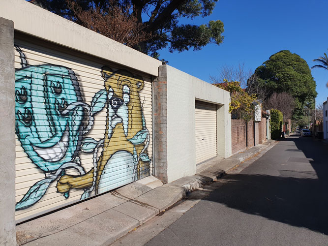
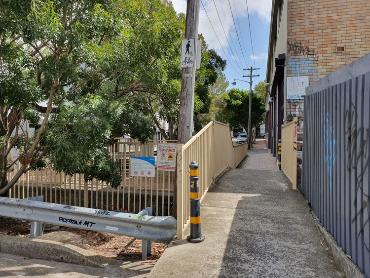
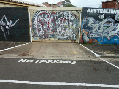
I do not walk down the slope, but keep following the ridge as best I can as it winds between houses, across streets, down back lanes. I am getting closer to the less respectable surrounds of Parramatta Road; graffiti and garage-door murals are starting to appear.
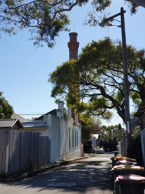
Then, beyond the Seventh Day Adventist Church, I spot another surprise. It is the top of a tall, brick sewer vent.
My route takes me through more twists and turns until I come to the entrance of Percival Lane. And there, on the next corner, is the magnificent sewer vent standing in the front yard of a little house. White wisps of condensation float from the chimney into the cold blue sky.
Just half an hour ago I had a flash of insight into this area’s geomorphology. But now I have reverted to admiring the monumental accoutrements of civilisation. Later I will read that this is a ‘classicist late Victorian sewer vent’ with Sydney Water heritage number 4572732.
I have had enough excitement for the day and resolve to resume my walk on an overcast day when I can get photos of the vent and its house without the dappled shadows cast by street trees. I return to the car via a lane beside the Seventh Day Adventist Church, where earlier I noticed a rustic little table in a throwout pile. I will use it as a plant stand in my backyard.
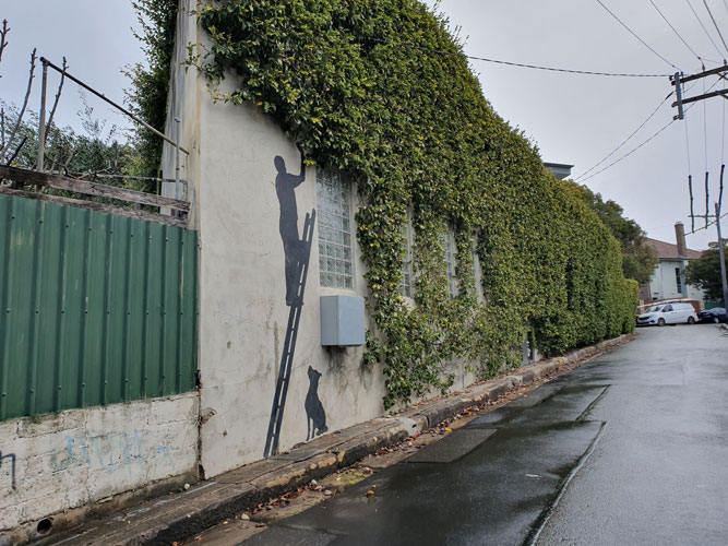
There’s a man up a ladder picking inedible figs as his dog watches on. Eye-catching in its simplicity, this back-lane mural will turn out to be today’s most interesting find as I resume my tracing of the Johnstons Creek catchment rim.
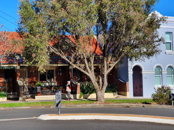
I am in the staid north-western corner of Stanmore, which is characterised by rows of neat, late 19th century houses. Yaz, the Completing Sydney blogger, visiting this suburb for the first time not so long ago, decided that ‘here is that combination of historic and adorable that we come to expect from the Inner West’, making it ‘the kind of place you might want to live in if you’re after that quiet suburban life, not too far from the city – perfect for small families who also happen to be multi-millionaires’.
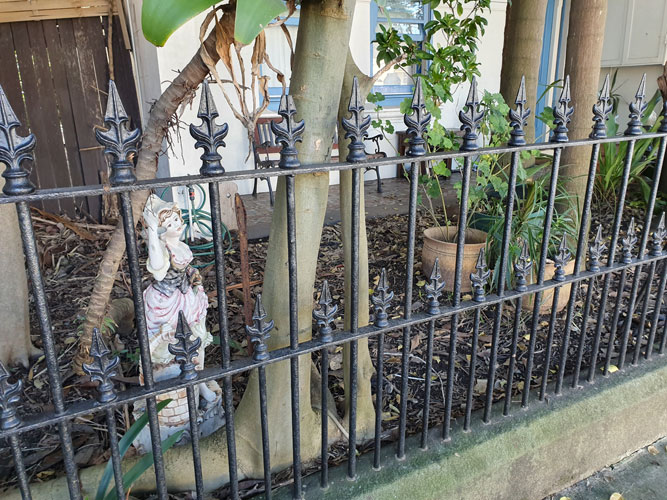
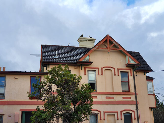
As I emerge from a knot of neat, rubbish-less back lanes there is an imposing house opposite with bird cowls on its chimney. Spot the real bird on the television aerial! I’ve had to look up ‘bird cowl’, the correct term for these covers that apparently increase the draft of a chimney. In this neighbourhood there are flocks of them. Perhaps the original builders of these houses did not foresee that ridge-top winds would blow smoke back down the chimneys. Original features, such as mantelpieces and fireplaces, are a real estate selling point in Sydney’s older suburbs, but I wonder how many owners persist with wood fires for their heating in winter?
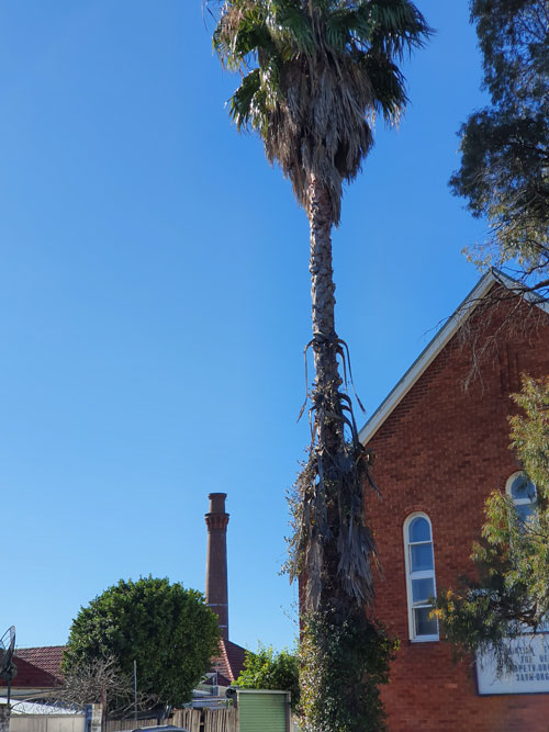
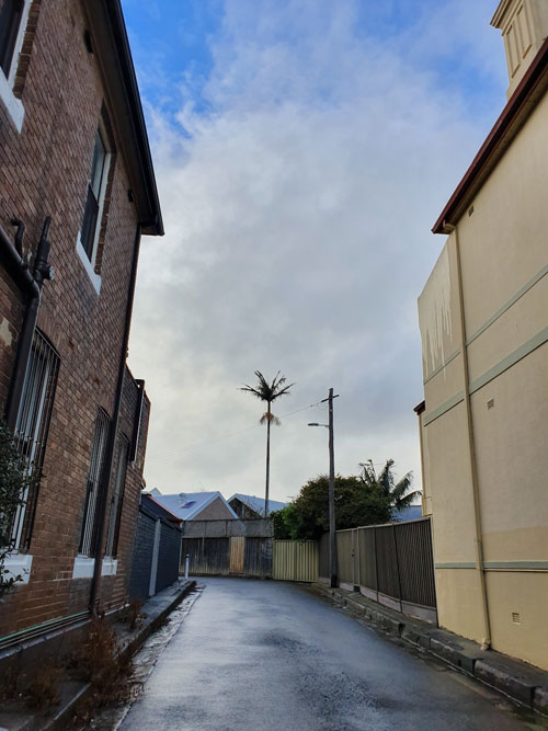
After turning a few street corners I come to a place where the ridge line ducks between two houses. Detouring round the block to get to the spot where the line emerges in a rear lane, I will use the tall palm tree as a marker.
I find the palm tree, but I have been out for the allotted Covid-safe outdoor exercise hour so it’s time to head back to the car.
In any case the clouds are louring and it’s going to rain again. I turn my back on another flock of bird cowls bracing themselves for the worst.
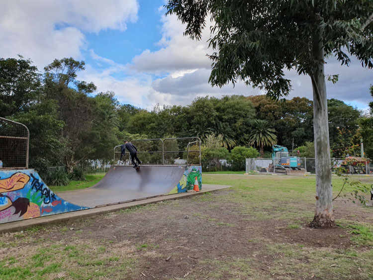
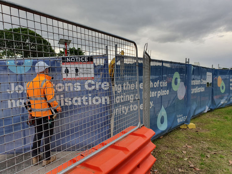
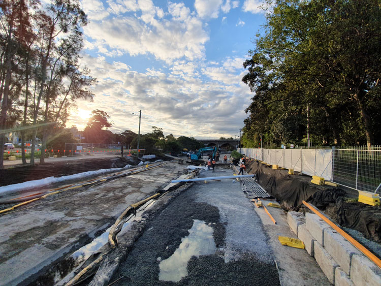
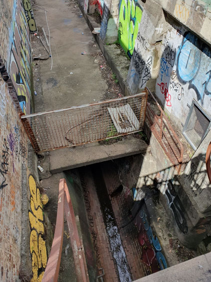
For this last journey along Johnstons Creek we take a path not far from Tramsheds, but on the opposite side of the canal. To follow the concrete line of the canal towards Rozelle Bay, we begin beside a skate ramp and an assembly of earth movers standing by to work on Sydney Water’s ‘naturalisation’ project.
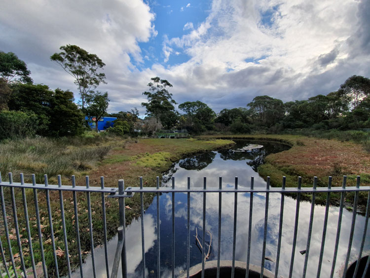
Not far along the sandy path I am surprised to see a reed-fringed pond with a signboard, ‘Federal Park Wetland’. The sky to the north is threatening, but above us there are blue patches and their reflections match the colour of the pet supplies barn beyond the trees. Overflow from the pond empties into two basins and, on the other side of the path, we see that it has run underneath us to the canal.
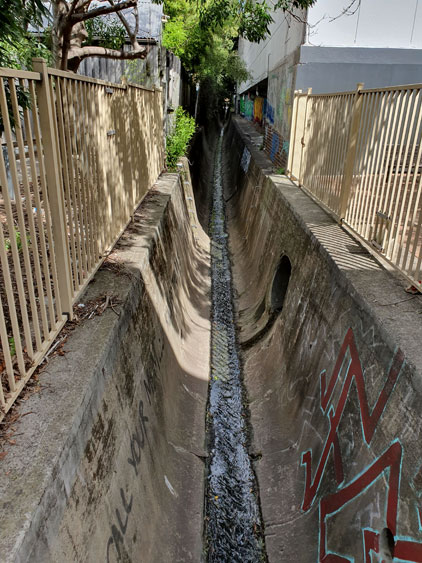
The tide is out, or perhaps it was prevented from coming in. The canal is dishevelled, strewn with pipes, barricades and building site paraphernalia. Water pumped from somewhere upstream pours from a large black hose. This scene is so different from the almost-idyllic autumnal waterway that we looked back on from the sunny Glebe foreshore in April.
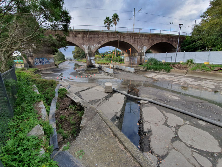
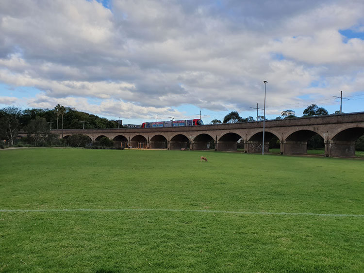
The rail viaduct is the next landmark. Built to carry steam trains taking goods to and from Darling Harbour, it has since been modified with overhead electric wires for the Metro light rail. From where Federal Park has widened out into a grassy but soggy playing field we can look back and admire its elegant curve and graceful brick arches.
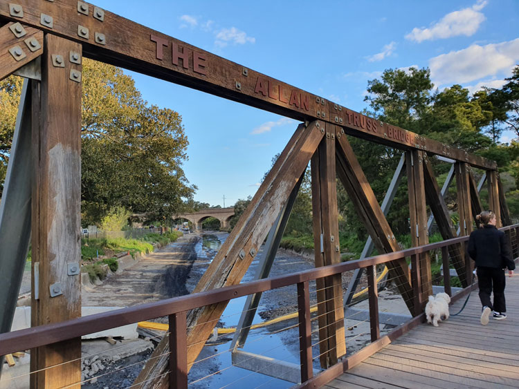
Further on, after stepping along a temporary plastic path between safety fences, we arrive at the feted and recreated Allan Truss Bridge. This is the spot where we abandoned our foreshore outing in April, which means we have completed our piecemeal exploration of Johnstons Creek proper, from drain to bay. Over the weeks we have encountered twelve bridges across the canal, passed under two mighty viaducts, and walked over countless hidden feeder pipes and drains.
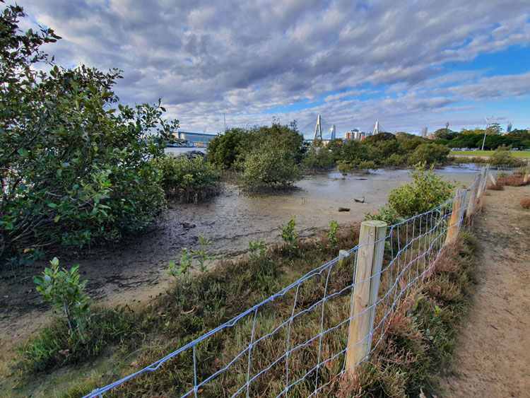
The characteristic salty-muddy smell of a tidal flat accompanies us as we cross the truss bridge. On the other side a large section of Bicentennial Park has also become a reconstruction site, where hard hats must be worn and 1.5 metre distancing observed.
We now return to where we started today, this time taking a route along the eastern side of the canal between more wire safety fences and the trim white picket fence of Jubilee Oval.
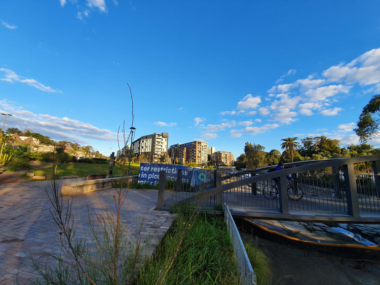
Back at the two bridges that cross from The Crescent in Annandale to Harold Park and the Tramsheds food mall in Forest Lodge, I look upstream towards the vast residential development that has replaced the Harold Park Paceway. Before embarking on this last Johnstons Creek excursion I have done some reading and I now realise that this whole area is a broad, flat valley. Although there are acres of open space, nothing is orginal. Not the concrete-confined creek, nor the planted reed beds and grassy slopes in front of me. Behind me, not the little wetland, the tidy playing fields and parks, the Indian mynahs splashing in the canal, nor the neatly walled edges of Rozelle Bay. Not even the trees.
In this valley Johnstons Creek once stretched out as a wide estuarine wetland with tidal mudflats and mangrove thickets, but in the 19th century the valley was filled with spoil from elsewhere in the curiously misnamed process of reclamation.
Over the generations since then, various organisations and departments have argued and compromised and acted to shape the land to their various needs and wants – grassy parklands and avenues of trees, factory sites, warehouses, timberyards, tramyards and a racecourse. Similar wrangling has characterised more recent efforts to restore fragments of the ‘reclaimed’ valley to a semblance of its former self.
So we have reed beds adjacent to a high-rise development, an artificial wetland fed by real runoff, newly planted patches of native vegetation (some already infiltrated by exotic weeds), and a corner of mangroves in an area small enough that it doesn’t encroach on open space. The latest change is Sydney Water’s grand naturalisation project which includes, among other things, replacing the concrete banks of the canal with sandstone and native plants, and expanding the salt marsh around it. The City of Sydney’s concurrent scheme to improve The Crescent and Federal Park will feature less natural works, like a skate plaza and picnic areas with barbecues.
During my walking and reading explorations I have been disappointed not to find specific references to pre-20th century Aboriginal people who might have frequented the immediate environs of Johnstons Creek. Recently written descriptions and histories of the surrounding suburbs usually begin with the obligatory generalised nod to the Cadigal and Wangal people of this area before getting on with the ‘real’ history. But even in serious accounts I have found no mentions of these people that can be pinned specifically to Johnstons Creek, nor can I find any stories handed down through generations, or contemporaneous mentions of Aboriginal people being seen here, or any records of archaeological discoveries.
It stands to reason. The region now covered by the suburbs of Stanmore, Camperdown, Annandale and Forest Lodge was very close to the original colonial settlement of Sydney, so even before the very early land grants were made here, most Aboriginal people had probably gone. During the subsequent periods of farming, subdivision and urbanisation, any traces of the original people would have been dug up, buried, built over or wilfully ignored.
Still, there is enough evidence from nearby or similar areas to suggest how these people lived. They might have hunted in what the colonists called the ‘Kangaroo Ground’ where Johnstons Creek rose. The might have accessed its fresh water. They would have probably frequented the sandstone ridges of now-suburban Glebe overlooking the estuarine valley, staying in overhangs like the rock shelters with associated middens that have been found not so far away in Lilyfield and Birchgrove.
They would not have lived in the watery valley but almost certainly foraged there, just as people did in the long-ago ‘reclaimed’ Blackwattle Bay on the other side of Glebe Point, where archaeologists have recently uncovered several deposits of stone artefacts. Glebe historian Max Solling says there is ‘some evidence of Aboriginal middens – the remains of shellfish – in the narrow strip of remnant salt marsh fringing the lower parts of Johnstons Creek. The ark cockle, scallop and Sydney rock oyster and mud whelk found there indicate that this was a fertile swamp and a rich source of food for the first inhabitants’.
As this stage of my Covid-19 isolation project comes to an end social restrictions in New South Wales have been eased. I am not sure that I could muster the number of friends I am allowed to mingle with, but later in the week we are having lunch with two friends. They are volunteers with the State Emergency Service and so are interested in previous waterways and potential flood zones. Perhaps we will talk about the buried tributaries of Johnstons Creek that I have yet to explore. I want to hear more of their stories about local streets that turn into torrents, and basement pumps, and flooded police cells.
References:
Attenbrow, Val, Sydney’s Aboriginal past: investigating the archaeological and historical records, UNSW Press, 2010.
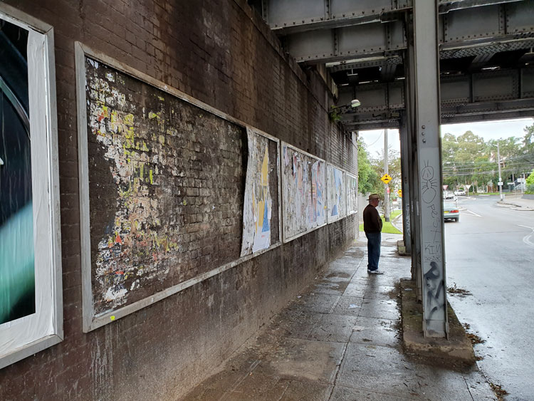
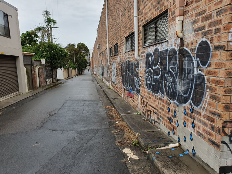
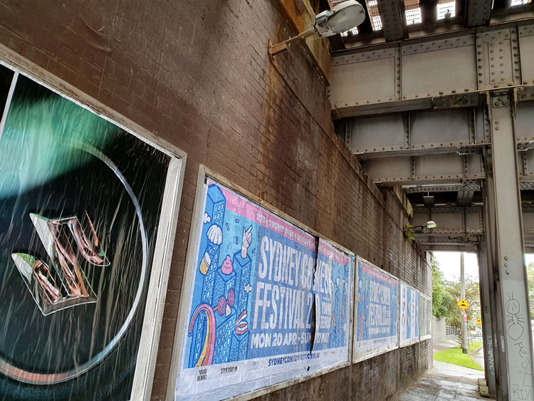
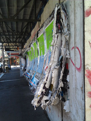
It is raining lightly and the urban currawongs are going joyously berserk as we set off. Having visited the mouth of Johnstons Creek we are now looking closer to home for its source, guided by an 1887 map of Sydney suburbs. We begin at the railway underpass in Liberty Street, Enmore, with its shredded posters. The Man Who Walks Ahead watches two bill posters posting on the opposite wall.
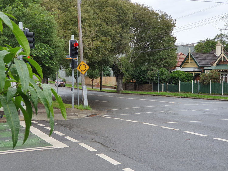
Crossing to the nearby roundabout I can see the spot that the map indicates as the beginning of the creek. It’s in a dip of what must have been a soggy paddock but is now Railway Avenue.
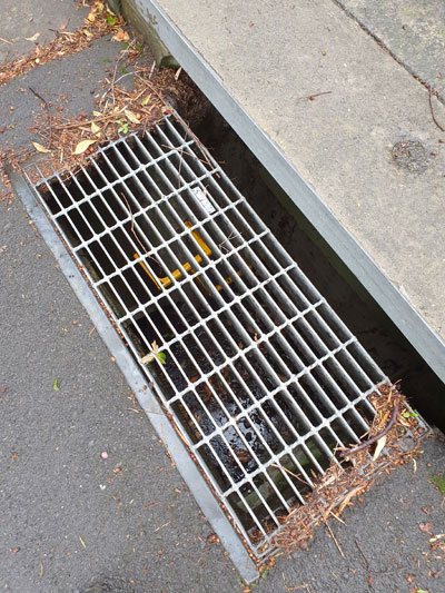
Tracing the creek from its source now becomes a matter of following the lie of the land and peering down grates in the roads to deep stormwater drains with yellow ladder rungs and sky glinting off water at the bottom.
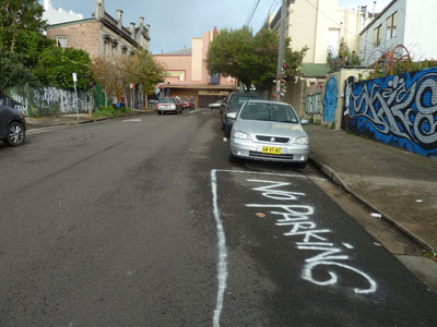
We come to a corner where we can look down Salisbury Road. In the dip there is the paling fence that screens off Johnstons Creek where it modestly emerges from underground and continues its journey cosseted by an open air canal. But we have been there before so instead turn up the hill to imagine how rainwater runs above and below ground down towards the concrete creek. In a back lane a piece of wall-and-pavement graffiti helpfully depicts this process for us.
Our long walk has taken us through corner country where four suburbs meet. As we circle back to our starting point we find that those bill posters have renovated both sides of the underpass.
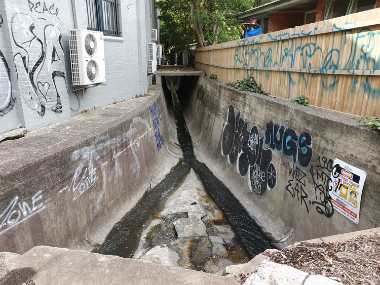
I have moved a short way upstream for today’s visit to Johnstons Creek. After inspecting the canal where it passes deep under Parramatta Road I am tracing it backwards and find that the next available viewing point is in a Stanmore street cut in half by the canal. A pedestrian bridge joins the two halves. The concrete waterway is flanked by factory walls on one side and backyard gardens on the other, whose overhanging trees hide shady secrets. ‘Call Your Mum’, urges a graffiti message. We set off to find what’s around the corner further upstream.
One last push on to Salisbury Road and I find what I’m looking for. This is where Johnstons Creek emerges from beneath its permanent suburban cover. Surprisingly there’s another large drain that joins it. It’s time to go home and study old maps to find the sources of the creek and this underground tributary. They don’t always form such a lazy trickle. I’m later told that trainee volunteers with the local SES are brought here on ‘flooding hot spot tours’.
This week I was reminded that Sydney’s supreme suburban explorer, Vanessa Berry, has already tracked Johnstons Creek on her Mirror Sydney blog. Different eyes. We will compare notes next time we meet, whenever that might be. ‘Happy New Year Mate’ wishes another graffiti message in blue paint. Anxious strange year is more like it.
It is the beginning of social isolation and I have devised a plan that involves, not staying in, but getting out into the customarily deserted streets of suburbia. To keep me exercised and interested, but distanced, I will try tracing the paths of local waterways, most of them now hidden underground or confined to canals that lurk around back lanes. My Journal of the Plague Year will document a watery wander.
I start with Johnstons Creek, a notable watercourse on the inner western fringe of central Sydney. It is named after Lieutenant George Johnston, who arrived as a marine on the First Fleet in 1788. Within a few years of the colony being established Johnston was granted a parcel of land and this creek formed the eastern boundary of his property.
My first excursion takes me to Parramatta Road, which crosses Johnstons Creek part the way along its course. Peering over a railing I can see the creek still flowing way down in the bottom of its ovoid stormwater canal. Before writing up this journal entry I learn from someone close to me that her graffiti crew used to spray here. But that was many years ago. I doubt there’s anything of hers visible now.
A Bicentennial plaque set into the concrete footpath tells me that a wooden bridge was built here in 1839. There are remnants of a subsequent sandstone bridge on the other side of Parramatta Road. More graffiti, including the name of a well known street artist who’s just recently been charged with sexual assault.
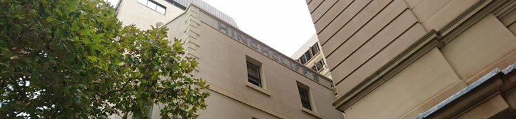
I am researching the history of a nineteenth century row of houses in Sydney’s inner west. It’s not my usual kind of writing gig but it has been interesting following the money. Wealth accumulated in good times by an enterprising immigrant from Yorkshire, shared with his son as a business partner, lost when the son’s extravagant ventures are caught out by a national financial depression. What’s left is a smattering of properties that have been salvaged for heritage listing by repurposing – gentlemen’s residences divided into flatettes, a wool store fitted out as university outpost campus, a private mansion transformed into a Catholic educational institution. Â
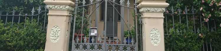
The buildings are notable for the need these colonial nouveau capitalists had to monogram their possessions. The firm’s name is embossed on the wool store – an understandable commercial imperative. But on the gateposts of the father’s 1860s villa his initials AH are stuccoed in botanical calligraphy so elaborate that they are barely legible.
Â
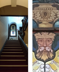
The son’s entwined initials JH in more restrained but authoritative capitals decorate the interior of his opulent 1880s mansion. I can imagine the thrill of self-satisfaction this sleek young mayor experiences as he glimpses the stained glass panel on his way upstairs from the expansive vestibule of his domicile.
Â
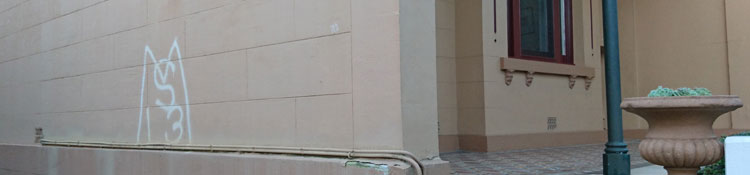
Fast forward to the late twentieth century and an upsurge of the monogram for marking property – though more likely someone else’s property or else a piece of public infrastructure. Taggers appropriate territory with marks that are generally illegible except to themselves or to cohorts that matter.
 I came across a graffiti supplies website recently, and this comment from a user: ‘ I wrote the name test when i was in high school. I liked it cause every time i saw the word test in a context totally unrelated to graff i creamed a little’.
 Here is the thrill of self-affirmation. This graffitist has gone for ordinariness over illegibility for his tag, and finds satisfaction when he sees,  not only the property he has marked,  but every single item where his moniker ‘test’ happens to appear – books, advertisements, notices, school whiteboards. His mind (and his member) believe that all these base are belong to him.
 At least what you don’t really own and have not mortgaged will not send you bankrupt.
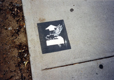
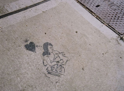
Images by meganix, taken in 2017 in Sydney: Stanmore, Circular Quay, Newtown and Strathfield.
In my so-called office at home I am attempting to regain control. The room has been overtaken by stuff and progress is slow because I have neglected the fundamental rule: DON’T READ.
Amongst things that I have sinfully paused to read while culling superseded files, I found notes I took at the orientation day for new PhD students in the Division of Society, Culture, Media and Philosophy at Macquarie University in 2008. It was on that day, by the way, that I discovered I was not the oldest PhD student in the world, and that there were many other culmination-of-career candidates. Anyway, here’s one piece of advice I dutifully noted:
At the beginning, keep a journal of what you read and what you think about it. Your notes will be like Ariadne’s thread leading you through the maze. They will help you to solidify your thesis topic or even change your mind about what that might be.
“Suck shit up”. Stanmore, 2003.
Well, I did start a journal, which became a series of A5 notebooks. The PhD has since been completed but, many volumes later, I still keep this journal, with notes on what I have read, seen, heard, talked about, and thought about. It is quite separate from my daily diary of appointments and humdrum domestic events. As a diversion from room-tidying I hunted out Volume 1 to re-read the first thing I had written in the journal. Here it is (slightly edited):
If I am going to do this project I am going to have to re-find my belief in the magical properties of the pavement. These last few years my writing and thinking have become prosaic. I have lost fun and wonder – beaten out of me by [my workplace]. When I first started photographing footpaths eight years ago, suddenly I could write poetry.
Over the next few years I did manage to recapture the magic as I enjoyed the luxury of exploring, photographing, reading, thinking and writing without the need to churn out memos, attend interminable meetings, play office politics, carry the dead weight of work-shy colleagues and endure the hysterics of others, attend to bureaucratic niceties and write formulaic justifications for every decision – and that was in what many (including myself) would have considered a dream job.
Once I left that job, how lovely it was on a nice sunny day to admire the sparkles in the asphalt and concrete, on a nice rainy day to enjoy the wavering reflections of the world on the ground, and on any day to seek out the messages people leave on the pavement and speculate why they leave them. And, in imaginary dialogue with scholars past and present, to discuss both the enchanting and the disheartening aspects of public places, and to consider what’s so special about the pavement.
“Bread is making birds sick”. Enmore, 2010.
These days I’m a bit more relaxed about the pavement. I don’t feel I have to look at the ground all the time in case I miss something, but I’m still interested in what’s so special about other places in the urban landscape that are so obvious they’re invisible.
Poster history book. Petersham, 2014. All photos by meganix.
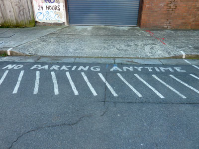
This is a story about the struggle between the green and the grey, between leaves and asphalt, between street trees and street parking, between what ought to be and what is. In inner city suburbs like Enmore and Stanmore, Marrickville Council is caught in this struggle.
One of the most stressful aspects of urban living is the shortage of parking. Suburbs that sprang up in the Victorian era, when there was no such thing as a motor car, are now undergoing gentrification; households often have more than one car but few houses have off-street parking.
Given the convenience of public transport in area, why do these people need cars? Partly it’s snobbery. Does your solicitor join the plebs on a bus to work? Would your doctor be seen dead in a train? Partly it’s necessity. With both parents working, try juggling work hours, childcare drop-offs and pick-ups, and Saturday sport all over the city. However much people might agree in principle with the environmental benefits of public transport and bicycle riding, often these are just not viable options.
Stanmore, 2014.
Shortage of street parking spaces is made worse by visitors to the area. Now that Enmore has become a ‘vibrant entertainment precinct’ hundreds of customers come in the evenings to attend performances or enjoy the many new restaurants, bars and cafes. And they don’t necessarily want to travel across the city in public transport at night to get home. So they infiltrate ever-deeper into residential territory to find parking for their cars. Residents jealously guard driveways (if they have them) and fume when they have to park blocks away from their homes. Marrickville Council knows all this and is trying to address the problem with committee meetings, surveys, community consultation, plans and projects.
Enmore, 2014. Enmore Theatre is in the background.
So why is Council intent on reducing the amount of parking in contested areas, rather than finding extra spaces? It’s because they are also committed to an Urban Forest Strategy that ‘recognizes the urban forest as an essential, living infrastructure asset and resource that provides a wide range of social, environmental and economic benefits’.
And this is what has prompted the demonstration project in Cavendish Street, Enmore, where large Lilli Pilli trees have been planted in structured soil in the roadway. I wrote about this project in my earlier post ‘What lies beneath’. And even though ‘permeable paving’ means that the space taken up by tree-planting ‘blisters’ is smaller than would normally be needed to keep trees healthy, there is no question that parking spaces have been lost. Residents of the street are supposed to have agreed to this arrangement, but they probably would have agreed to any scheme that saw the former huge, inappropriate and destructive fig trees removed from their footpaths.
Enmore, 2014. One tree gained, two parking spaces lost.
Meanwhile parking pressure on nearby streets has been increased just that bit extra. What’s more, Marrickville’s draft Master Street Plan has Lilli Pilli (Waterhousia floribunda) or similarly large trees slated for some of these same streets. Given the narrowness of the verges, this must mean more in-road planting and more parking lost. Residents of these streets are not going to be too happy about this.
A 2013 survey of residents in the Marrickville Local Government Area found that most people like having greenery in their suburbs. Of course. But what the survey doesn’t mention is that householders also like to park close to their homes and businesses don’t want customers put off by lack of parking. Until a whole lot of things in the world change, this reliance on cars and the need for parking isn’t going to go away. In-road planting is an impractical component of the urban forest strategy and would have measurable social and economic costs. An ideological commitment to such a component would have a detrimental, not a beneficial, effect on the local area. Small trees, please.
My WordPress avatar is a pedestrian traversing the asphalt. Despite a continuous battering by passing traffic, you can see that my pedestrian still has a burning heart, thanks to an implant by the 90s band Junglepunks.
Pedestrian and Junglepunks, Broadway (Sydney), 1999
I have met many such pavement people since I began my graffiti project way back in 1999, but I seem to have only mentioned them once on this blog site. A desire to revisit them has been prompted by some of the photographs in a new little book by Phil Smith, Enchanted things, where he writes:
‘The pedestrian figures here were all intended by some designer as generic representations; yet to the glad eye they display their eccentricities, amputations, stretch marks, wrinkles, prostheses and rearrangements. They serves as memento mutabis (“remember you will change”), a reminder of your body as unfinished business, inscribed into its path and subject to all that passes along it, a history made on the hoof.’
In this photo-essay Phil, an ambulant academic at Plymouth University, UK, urges us to undertake an ‘experimental pilgrimage without destinations’ where disfigured pedestrian figures are just a small sample of the absurd, ironic and accidental artworks in the urban landscape that, if we take the trouble to notice them, will rearrange our attitude to the world.
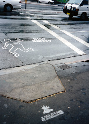
My Sydney pavement pedestrians serve to confirm that walking in the builtscape is no simple matter. They don’t need Phil to tell them they should LOOK, LOOK RIGHT, LOOK LEFT. But even if they have an opinion about what they see, they are made to shut up. It is sometimes permissible for them to manifest their gender or age status, but more often than not they are stripped to their naked genderlessness, a mere shadow of their supposed selves.
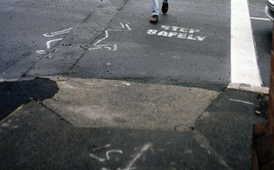
Although exposed to assault from all sides, they can hardly complain they weren’t warned. Even so, when cautioned to THINK BEFORE YOU CROSS and STEP SAFELY they generally decide to make a dash for it. Some do so with a defiant display of insouciance but others are so terrified by the traffic they jump right out of their shoes.
Pedestrian whose comments have been censored, Summer Hill, 2010
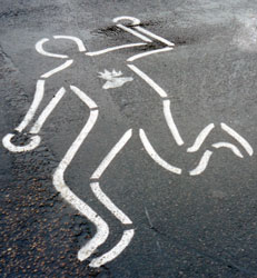
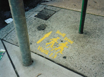
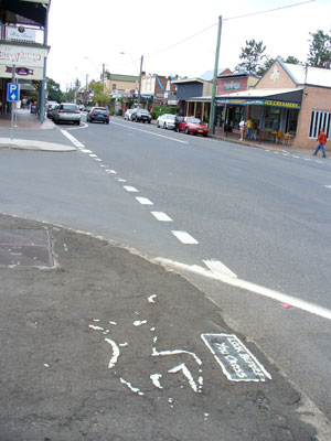
Wise walkers, Stanmore, 2000
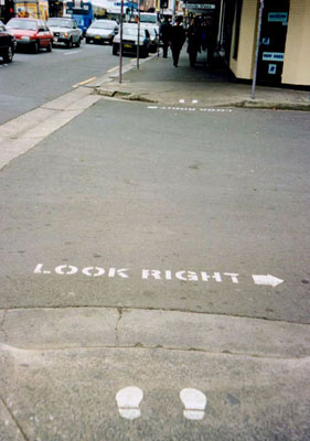
Unwise street crosser, Newtown, 1999
Left and right shoes left behind, Newtown, 2000
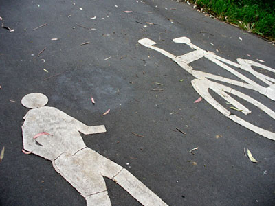
The more purposeful striders who stick to the footpath find they are obliged to share their way with cyclists and sometimes even elephants. Hidden trenches and falling manhole covers are additional hazards.
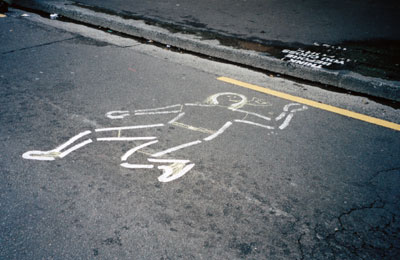
Casualties are high and many pavements are haunted by the remains of hapless pedestrians, last seen in healthy condition maybe twenty years ago, now reduced to making ghostly appearances from between the cracks in the asphalt.
Pathway parade, College and Liverpool Streets, Sydney, 2011
Pedestrian in trench, Newtown, 1999
Pedestrian under manhole cover, Chatswood, 2007
Traces of a pedestrian, Berry, NSW, 2007
Like my flat mates, I find it hard to keep up with Phil’s ambulant ruminations. Nevertheless, the next item on my reading list is another recent book by him, larger in size and no doubt equally challenging. Â It’s called On walking … and stalking Sebaldand its cover features an array of pedestrian figures. How could I resist?
Smith, Phil, 2014, Enchanted things: signposts to a new nomadism, Axminster: Triarchy Press.
Smith, Phil, 2014, On walking … and stalking Sebald: a guide to going beyond wandering around looking at stuff, Axminster: Triarchy Press.