WATERSHED MOMENTS. EXCURSION 3. REVELATIONS.

4 July 2021

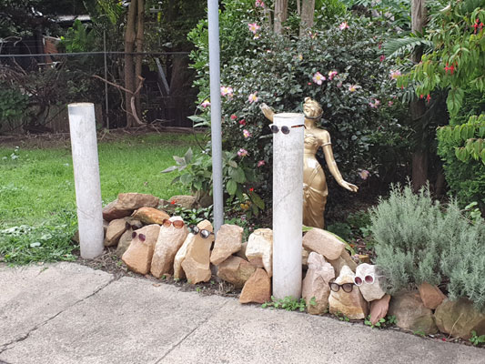
When I began my circumambulation of the Johnstons Creek catchment rim I was prepared for the unexceptional. Unlike last year’s explorations of the creek itself – when I found offbeat backstreets and mini banana jungles – on this series of excursions I expected that only the occasional quirky garden ornament or letterbox would relieve the familiarity of the suburbs I passed through.

This image has an empty alt attribute; its file name is 20210704_123310_BlogMilkmai.jpg

To some extent this is turning out to be the case, but on this third excursion I have a moment of revelation, and I also come across very large infrastructure treasure that somehow I had overlooked in all the years I have lived in the inner west of Sydney.

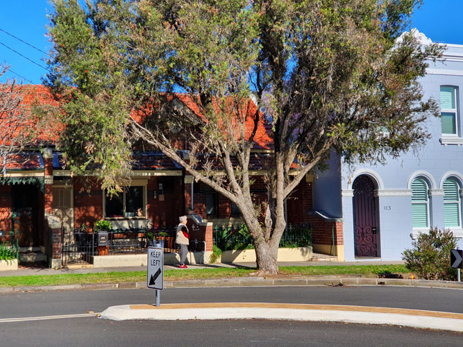
I started where the imaginary catchment line emerges from between two small, pretty and unremarkable brick houses in a style common to this neighbourhood of Stanmore. Nothing much is going on in the street except for an elderly woman taking in some sun on this cold but bright day.

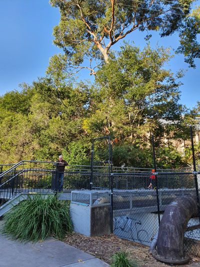
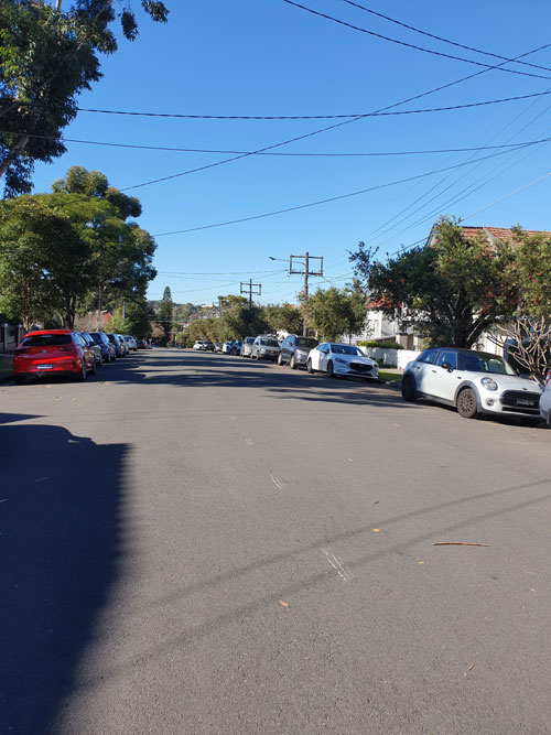
I stand in the middle of the road and look southeast down the slope. From here I can see across to the other side of Stanmore, and beyond that what must be the telecom tower on the opposite ridge in King Street, Newtown. I am surprised to realise I am looking across the valley of Johnstons Creek. This may seem obvious – I am, after all, standing on the catchment rim – but momentarily I understand the topography of the area without the distractions of urbanisation. There is no way I can properly capture what I am seeing in a mobile phone photograph.

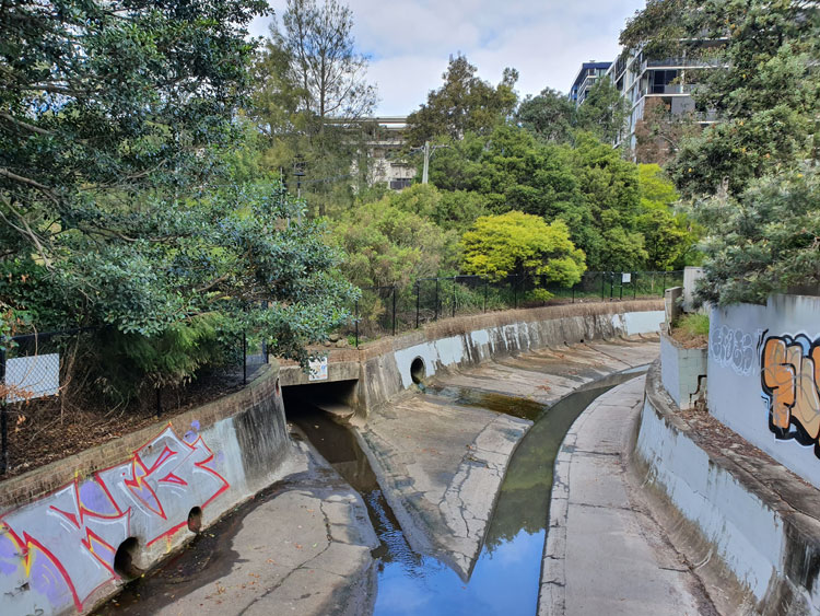
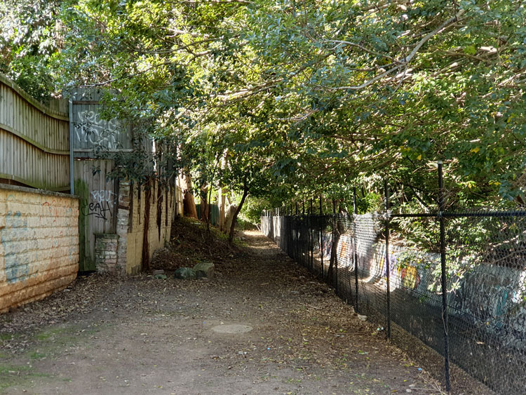
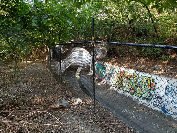
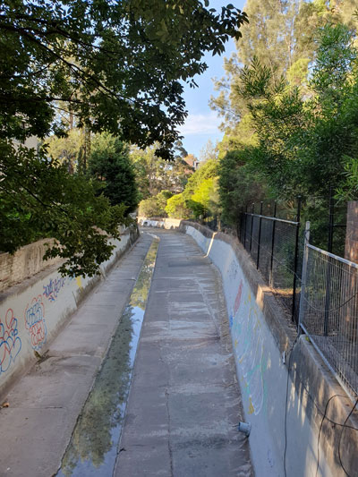
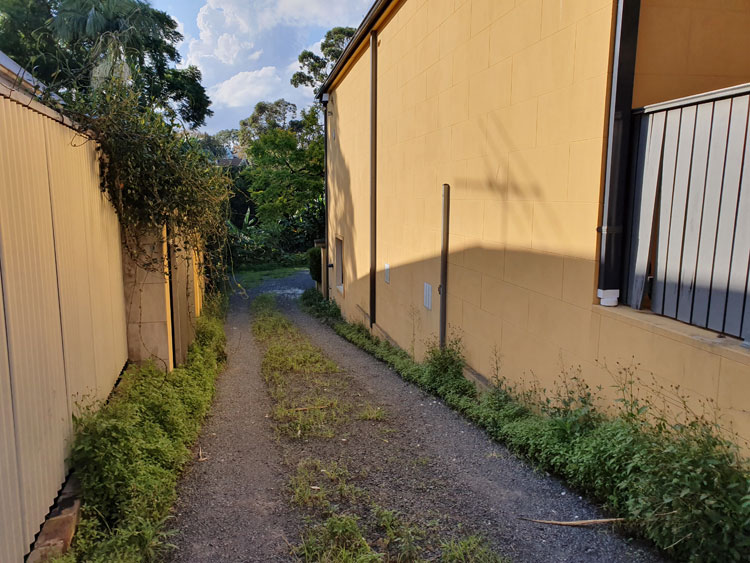
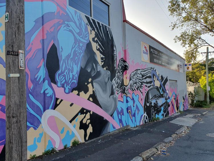
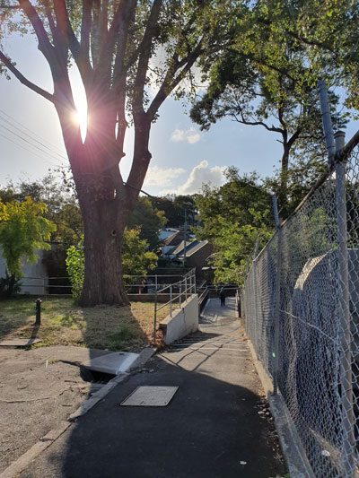
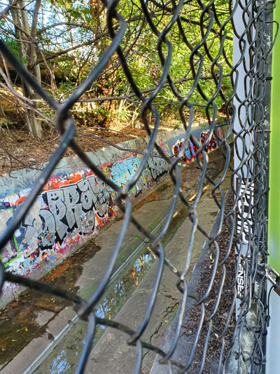
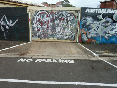
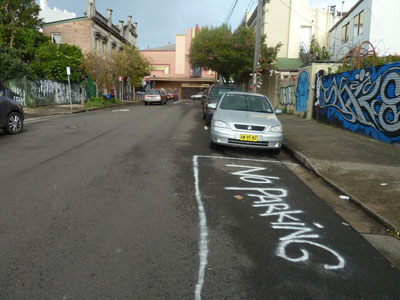
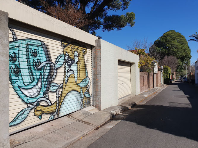
I do not walk down the slope, but keep following the ridge as best I can as it winds between houses, across streets, down back lanes. I am getting closer to the less respectable surrounds of Parramatta Road; graffiti and garage-door murals are starting to appear.

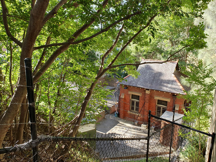
Then, beyond the Seventh Day Adventist Church, I spot another surprise. It is the top of a tall, brick sewer vent.                                                  

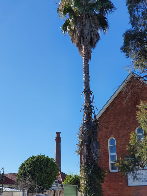
My route takes me through more twists and turns until I come to the entrance of Percival Lane. And there, on the next corner, is the magnificent sewer vent standing in the front yard of a little house. White wisps of condensation float from the chimney into the cold blue sky.

Just half an hour ago I had a flash of insight into this area’s geomorphology. But now I have reverted to admiring the monumental accoutrements of civilisation.  Later I will read that this is a ‘classicist late Victorian sewer vent’ with Sydney Water heritage number 4572732.

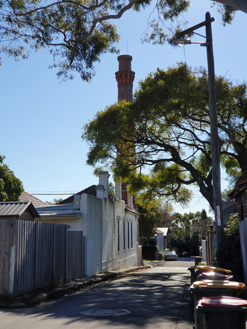
I have had enough excitement for the day and resolve to resume my walk on an overcast day when I can get photos of the vent and its house without the dappled shadows cast by street trees. I return to the car via a lane beside the Seventh Day Adventist Church, where earlier I noticed a rustic little table in a throwout pile. I will use it as a plant stand in my backyard.

Concrete Creeks. Excursion 9. A string of parks.

Sunday 17 May 2020

Johnstons Creek would have once been a pretty little bushland waterway but when the surrounding land was subdivided, houses and factories turned their backs on it. In 1838 it was described as ‘that invaluable stream of water’, but by 1892 it was condemned as a ‘fever bed’ with calls to commence the building of a canal because of the creek’s ‘menace to public health arising from the sewage nuisance’.

Our excursion this weekend takes us from one of the worst of those ‘nuisance’ areas at Wigram Road, to The Crescent in Annandale, and back again. The canal that was eventually built is wide but water is only flowing in the central gutter today. Signs warn us that this is a Flood Zone, so I’ll be back next time the weather is wild.

On either side of the canal is a string of tiny parks and reserves, each named separately, presumably as a way of keeping up with the backlog of municipal worthies who deserve recognition. In Canal Reserve we walk over several cheesy homilies neatly written in coloured chalk.

Beside JV McMahon Reserve we watch a pair of ducks emerge from where they have been dallying beneath a footbridge.

Near Minogue Crescent Reserve we see a woman practising solitary Twister beneath the arches of the area’s most impressive landmark, the Johnstons Creek Sewage Aqueduct.

In AV Henry Reserve there is a bubbling spring in the centre of a swamp which, a notice informs us, may be affected by sewage overflow.

We cross the creek by walking over the road bridge at The Crescent, then turn back and descend into Smith & Spindler Park where, with its wider grassy sward and smoother path, we now encounter the dreaded joggers, spandex cyclists, whole families on wheels, and off-leash dogs. We notice that a children’s playground has been reopened just this week.

To our left is the canal which, for some reason, has been blocked from view by a dense planting of casuarina trees. To our right, beyond the grass, is Nelson Lane, currently decorated at regular intervals with piles of discarded domestic ware, the product of lockdown busy-ness.

Our limbs still intact and our lungs too, we hope, we press on back to Wigram Road, via the narrower Hogan Park, where a town house dweller has annexed public space outside their back gate to create a canalside pleasure dome complete with outdoor chairs, a swing, pot plants and plastic grass.

Concrete Creeks. Excursion 8. The tunnel of love.

Wednesday 22 April 2020

Today we pick up where we left off just a few days ago at Chester Street footbridge, to see if it’s possible to walk beside Johnstons Creek canal as far as Booth Street. We find there is public access behind houses but the ground is rough and covered with leaves from overhanging trees. Garden rubbish tossed over from backyards, most of it large palm fronds, makes the going tougher. Mosquitoes are biting in the shade but ahead the canal makes an elegant S-curve and, backlit by the autumn sun, the arch under Booth Street becomes a Tunnel of Love.

We scramble up to the roadway via another mini-reserve, this one called Badu Park. Cyclone fencing, orange plastic barriers and a roadside port-a-loo signal that the bridge is a construction site. It’s being widened, the notices on the fences say, and will have better footpaths and a bike path. Hopefully the two present-day councils responsible came to an agreement about who paid for what without the years of bitter feuding and name-calling that went on between Leichhardt and Camperdown Councils when the present bridge was built around 1898 to replace an old wooden bridge.

Beside the canal where it emerges from under the bridge there is a quaint brick and sandstone Federation-style building, partially hidden by trees and fences. It’s SPS 3 or, as I later confirm from Sydney Water’s heritage listings, Sewage Pumping Station No.3 built around 1901.

To get a better look at SPS 3, I walk down a stump of a road and across a small bridge below the level of Booth Street. From here I can also see where the canal continues around a bend before it is joined by Orphan School Creek near Wigram Road. That confluence was the location for one or our earlier excursions.

This is as far as we are going today. There’s a café nearby but if we want coffee we must line up in an orderly and properly distanced queue.

Postscript. By coincidence, in the following morning’s Sydney Morning Herald there’s an article about a $20 million scheme to upgrade small public spaces in Sydney’s inner west. One of the projects is a shared pedestrian and cycle path to be constructed along Johnstons Creek from Wigram Road to Chester Street. That’s the same rocky route we have just taken. Soon there will be no tossing of dead palm fronds over back fences.

Concrete Creeks. Excursion 7. The tip.

Sunday 19 April 2020

It’s over three weeks since we visited this light industrial triangle between Johnstons Creek and Pyrmont Bridge Road. There have been other excursions in between but now I’m back to find out what happens to the creek beyond the forbidding metal fence where it drops into an open canal behind Water Street.  Just a few neatly kept little houses remain here, tucked between hulking factories and warehouses, and we have come on a Sunday hoping to avoid large trucks squeezing into delivery bays. I walk down a driveway between two houses in Water Street and find that it opens onto a gravelled space bounded on three sides by buildings and on the fourth by a thick jungle of banana trees, castor oil plants, convolvulus and asthma weed. With no machete available I can only peer down the steep slope for glimpses of the canal wall, recognisable by its symbiotic graffiti.

Frustrated by the banana jungle we move east to a wider industrial street that leads directly down to the canal. I have never been on Chester Street before but later I will read that there was once a household garbage tip amongst the houses on this side of Johnstons Creek. It was the source of much friction between the adjoining boroughs of Camperdown and Annandale in the late 1800s. For fifteen years countless  newspaper column inches were taken up with reports of council meetings and letters to the editor on the subject of the Camperdown tip, whose ‘deadly effluvia’ made the creek filthy and ‘endangered the lives of the residents of North Annandale’. There are no houses here now and no tip. Instead there is a motor repair business with a wild piece of wall art.

We walk down the hill to a newly-built footbridge over the canal. On the other side of the dip the street climbs up between the Federation houses of re-gentrified Annandale.

Everything here looks new, but the two playgrounds  are roped off to prevent children from disobeying social distancing rules. This tiny canalside reserve is called ‘Douglas Grant Memorial Park’ in honour of an Aboriginal man whose original name was Ng:tja. The survivor of a massacre, in 1887 he was taken as a toddler from his North Queensland home thousands of kilometres away and brought up in Annandale as a member of his captor’s family. His story is told on two plaques.  It does not end well.

By taking a short walk along where this narrow park skirts a series of backyard fences, I can look across to the place where I had earlier tried bush-bashing.  The clear band of water that I couldn’t see from the other side reflects the sky, but the graffiti is old and dilapidated, as if the renovation of the area has made the canal too public for spray painters.

This nook in Annandale is a revelation to me. But not to locals of course. Not the cyclists and joggers intermittently crossing the bridge. The two young men casually shooting a basketball. The squealing children doing wheelies on their scooters. Nor the three teenagers sitting at a picnic table and idly chatting not quite 1.5 metres apart.

Concrete Creeks. Excursion 4. Deep water.

Friday 27 March 2020

For the fourth of our piecemeal visits to Johnstons Creek we return to Parramatta Road and plunge into the narrow streets on the northern side where a light industrial triangle is squeezed between the creek and Pyrmont Bridge Road. The streets slope down to a concrete pathway that covers this section of the canal. We turn left and find ourselves at the sandstone bridge on Parramatta Road, where thousands of cars pass Stanmore McDonald’s every day. The creek traces a silvery line through the shadows under the road.

Turning around to follow the flow of the creek we walk between the backs of properties, respectable Victorian houses on one side, factories and derelict houses on the other. The path comes to an abrupt end at a metal grate and fence. Beyond is a deep channel of coolness where we can hear the creek falling. A bird calls from somewhere in the overhanging shrubbery.

We scramble up into a grassy area at the foot of Water Street. I will later read a lengthy real estate advertisement from 1850, when the farm here was subdivided into housing allotments. This grassy area is described as “a RESERVED WATERING PLACE at deep water on Johnstone’s Creek [that] will add materially to the comfort of the occupants”. There are still some residences in Water Street as well as warehouses and the last house before the reserve has a small but unusual garden.

Walking back to the car I spot an abandoned shopping trolley and for a moment think I have come upon a cache of toilet paper.  But no, the cartload only consists of styrofoam packaging cylinders.

No parking

Enmore, 2014.

Enmore, 2014.

This is a story about the struggle between the green and the grey, between leaves and asphalt, between street trees and street parking, between what ought to be and what is. In inner city suburbs like Enmore and Stanmore, Marrickville Council is caught in this struggle.

One of the most stressful aspects of urban living is the shortage of parking. Suburbs that sprang up in the Victorian era, when there was no such thing as a motor car, are now undergoing gentrification; households often have more than one car but few houses have off-street parking.

Given the convenience of public transport in area, why do these people need cars? Partly it’s snobbery. Does your solicitor join the plebs on a bus to work? Would your doctor be seen dead in a train? Partly it’s necessity. With both parents working, try juggling work hours, childcare drop-offs and pick-ups, and Saturday sport all over the city. However much people might agree in principle with the environmental benefits of public transport and bicycle riding, often these are just not viable options.

Stanmore, 2014.

Stanmore, 2014.

Shortage of street parking spaces is made worse by visitors to the area. Now that Enmore has become a ‘vibrant entertainment precinct’ hundreds of customers come in the evenings to attend performances or enjoy the many new restaurants, bars and cafes. And they don’t necessarily want to travel across the city in public transport at night to get home. So they infiltrate ever-deeper into residential territory to find parking for their cars. Residents jealously guard driveways (if they have them) and fume when they have to park blocks away from their homes. Marrickville Council knows all this and is trying to address the problem with committee meetings, surveys, community consultation, plans and projects.

Enmore, 2014. Enmore Theatre is in the background.

So why is Council intent on reducing the amount of parking in contested areas, rather than finding extra spaces? It’s because they are also committed to an Urban Forest Strategy that ‘recognizes the urban forest as an essential, living infrastructure asset and resource that provides a wide range of social, environmental and economic benefits’.

And this is what has prompted the demonstration project in Cavendish Street, Enmore, where large Lilli Pilli trees have been planted in structured soil in the roadway. I wrote about this project in my earlier post ‘What lies beneath’. And even though ‘permeable paving’ means that the space taken up by tree-planting ‘blisters’ is smaller than would normally be needed to keep trees healthy, there is no question that parking spaces have been lost. Residents of the street are supposed to have agreed to this arrangement, but they probably would have agreed to any scheme that saw the former huge, inappropriate and destructive fig trees removed from their footpaths.

Enmore, 2014. One tree gained, two parking spaces lost.

Enmore, 2014. One tree gained, two parking spaces lost.

Meanwhile parking pressure on nearby streets has been increased just that bit extra. What’s more, Marrickville’s draft Master Street Plan has Lilli Pilli (Waterhousia floribunda) or similarly large trees slated for some of these same streets. Given the narrowness of the verges, this must mean more in-road planting and more parking lost. Residents of these streets are not going to be too happy about this.

A 2013 survey of residents in the Marrickville Local Government Area found that most people like having greenery in their suburbs. Of course. But what the survey doesn’t mention is that householders also like to park close to their homes and businesses don’t want customers put off by lack of parking. Until a whole lot of things in the world change, this reliance on cars and the need for parking isn’t going to go away. In-road planting is an impractical component of the urban forest strategy and would have measurable social and economic costs. An ideological commitment to such a component would have a detrimental, not a beneficial, effect on the local area. Small trees, please.

Enmore, 2014.

Enmore, 2014.

What lies beneath

New trees have been planted in Cavendish Street, Enmore, but for pavement fanciers the interest lies in the method used to install them. The process was far more complex than simply plonking a tree in a hole. It involved such things as ‘in-road planting’ and ‘structural soil’ and ‘plastic cells’ and ‘permeable paving’ – all designed to address ‘multiple issues, including impact of trees on infrastructure, safety of footpaths, enhancement of the urban tree canopy, landscape amenity and urban water management’.* And preventing the road surface from cracking or caving in.

Marrickville Council seems pretty pleased with the project, which is the first of its kind for this municipality, and maybe for the whole of Sydney. It’s been interesting watching the process, but I have some misgivings.

Cavendish Street, Enmore NSW, June 2014

It all started more than three years ago, when Marrickville Council began removing very large fig trees from the footpaths on the street. Although enjoyed by birds and bats, these trees broke up the paving and invaded underground pipes. I wrote a blog post about local mourning when the first tree was removed.

Cavendish Street, Enmore NSW, October 2010

‘Tree replaced by cement!’, Cavendish Street, Enmore NSW, October 2010

The story resumes in April this year, and here’s how it goes. The Council excavates three huge rectangular pits in the street, digging deep down into the clay beneath the surface of the road.

Cavendish Street, May 2014

Cavendish Street, May 2014

Underground infrastructure, including gas pipes, is adjusted and gravel is spread in the bottom of each hole.

Cavendish Street, May 2014

Cavendish Street, May 2014

Next, a layer of large plastic cells is positioned in the pit and ‘structural soil’ is tipped in between them. Another layer of cells and soil is added, this time with a rectangular hole in the centre fenced off with plywood formwork. As I understand it, the plastic cells act as support for the roadway above; the structural soil is a mix of gravel and loam that resists being compacted and allows tree roots to spread and grow.

Cavendish Street, May 2014

Cavendish Street, May 2014

Over the soil comes a layer of geotextile then another layer of gravel.

Cavendish Street, May 2014

Cavendish Street, May 2014

Concreters build retaining edges around the central tree hole to form a ‘blister’. This will prevent cars bumping into the tree trunk.

Cavendish Street, June 2014

Cavendish Street, June 2014

Permeable pavers are laid. Rain falling on the road will flow towards this area of porous paving. This means that street run-off will infiltrate the tree pits instead of gushing down the gutters and into stormwater drains.

Within a day or so, on a nice rainy morning, advanced trees are lifted into the central hole, the formwork is removed and more soil is tipped around the large root ball. The three trees are Waterhousia floribunda ‘Green Avenue’, a cultivar of the rainforest Weeping Lilli Pilli that is expected to grow to 16 metres.

Cavendish Street, June 2014. All photographs by meganix.

Cavendish Street, June 2014. All photographs by meganix.


The project is not quite finished. A garden will be planted inside each blister. But the safety fencing has been replaced by witches’ hats and the official photographer has been sent to take photos for Council publications. As the unofficial photographer and busybody I’m rushing into e-print with this blog post.

In my next post I will talk about how my admiration for this aboricultural and civil engineering feat is tempered by reservations about the push and pull of local council policies.


*Marrickville Matters, December 2013, p.9.

Traces of leaves

This week I chanced upon Pete McLean’s blogsite Art and About. Pete really does like to get about – in the natural landscape, that is – and his beautiful artworks include wood engravings as well as prints and rubbings from objects he picks up outdoors, such as bits of wood, mushrooms and leaves.

From time to time Pete makes ephemeral artworks in situ, composing handfuls of dried grass on a hillside, for example, or rearranging a drift of snow. But surprisingly he is also interested in the urban pavement and sometimes traces around fallen leaves on the footpath with chalk. For me it is interesting to discover one of those artists whose works you sometimes come across on the pavement without ever knowing who did them, or why.

But the blog post that originally caught my eye was a photograph of what Pete calls ‘concrete fossils, those special places in the suburban landscape where traces of leaves and other life have been recorded in the man made lithosphere’. Pete’s photographs reminded me of some I had taken in Stanmore (Sydney) a few years ago.

Leaf prints in Salisbury Road, Stanmore (Sydney), 2009.

I made a comment on Pete’s site, he replied, and I decided to write this post. But when I returned to his site to check that I had got things right, I found he had already written a post about Pavement Graffiti. Such is the incestuous world of the blogosphere. Thanks Pete and best wishes with your lovely creations.

Out of your mind

'You must go out of your mind in order to come to your senses', Fitzroy (Melbourne), 2011

A tiny public garden on a busy street corner in Fitzroy has been adopted by a man who, by his own confession, is addicted to colour. Here is a person who truly values the pavement as a medium of expression and is not afraid of the challenge that cobblestones present to an artist.

'Meme Corner', Fitzroy (Melbourne), 2011

The garden’s passé railway sleepers and tired pelargoniums are no match for the vitality of his patterns, diagrams and aphorisms.

'Addicted to colour', Fitzroy (Melbourne), 2011

I look forward to seeing how his Epicenter of Love has evolved next time I visit Melbourne.

'Epicenter of Love', Fitzroy (Melbourne), 2011

Tree replaced

I am still thinking about why it is that some graffitists choose to write on the ground rather than on a wall or some other vertical surface. And that means I’m still thinking about graffiti that is site specific – where the message is relevant to that particular piece of pavement.

Here is a sad little piece of correction fluid graffiti. Gigantic Hills Fig trees are progressively being removed from this street in Enmore. Their roots break up the paving and are apparently playing havoc with people’s walls and sewer pipes. Perhaps they were an inappropriate choice for a street tree. But the street is looking bare without them and some of the residents – as well as all sorts of birds – are going to miss them. The loss of one of the trees is recorded in this tiny, signed epitaph: Tree replaced by cement! T.T.  10

There is more discussion and photographs of this tree and other trees in the same street on the Saving Our Trees website.