Concrete Creeks. Excursion 10. The shark park.

Wednesday 10 June 2020

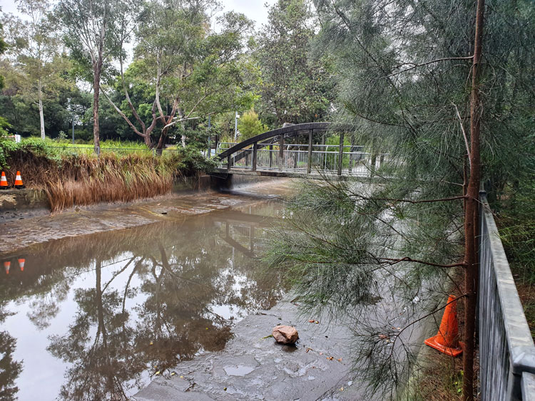
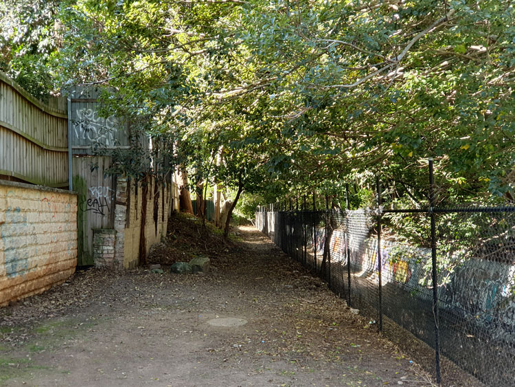
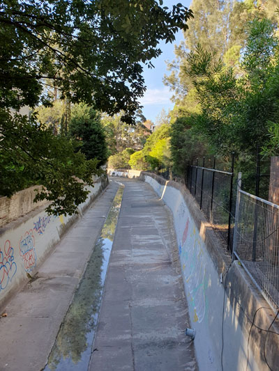
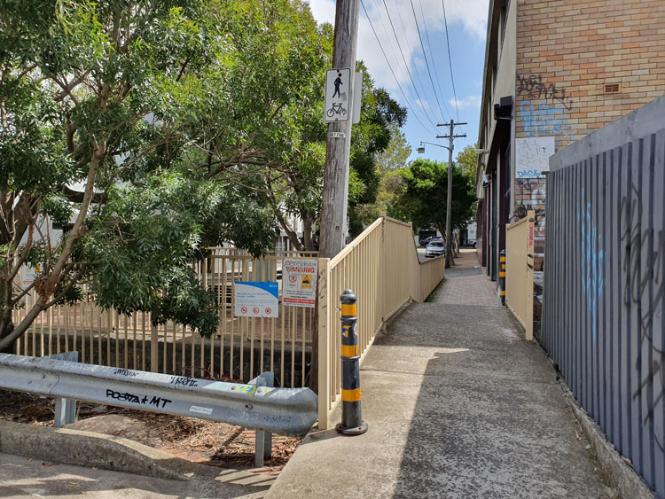
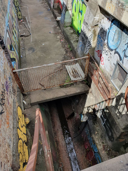
At the northern end of Smith & Spindler Park in Annandale there is a quaint arched footbridge across to AV Henry Reserve. After passing beneath this footbridge Johnstons Creek flows under a road bridge where vehicles swoop around the arc of The Crescent. The canalside pathway has a separate underpass below the road. I have chosen to follow this section of the canal on a rainy weekday in the hope of avoiding encounters with speeding cyclists on the shared path. I am the kind of pedestrian they hate – slow, meandering, crossing unpredictably from one side of the path to the other to take photographs.

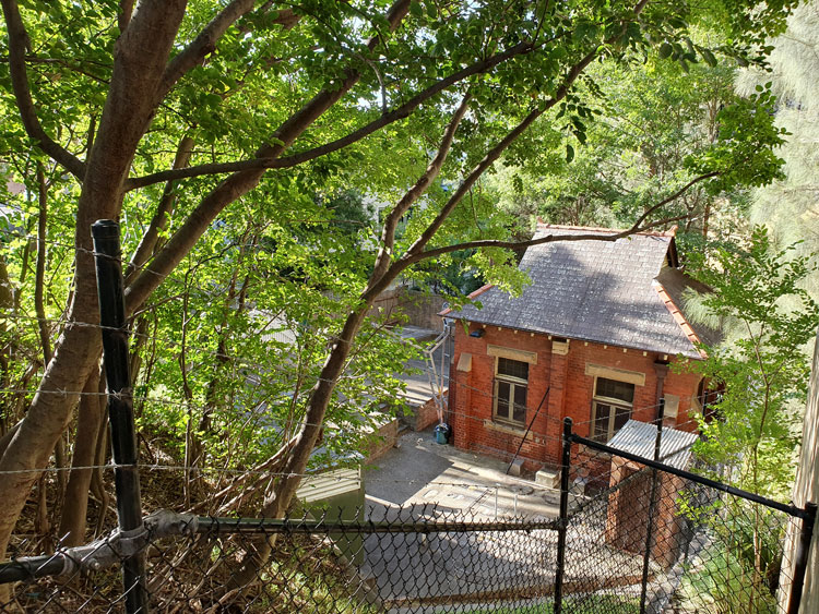
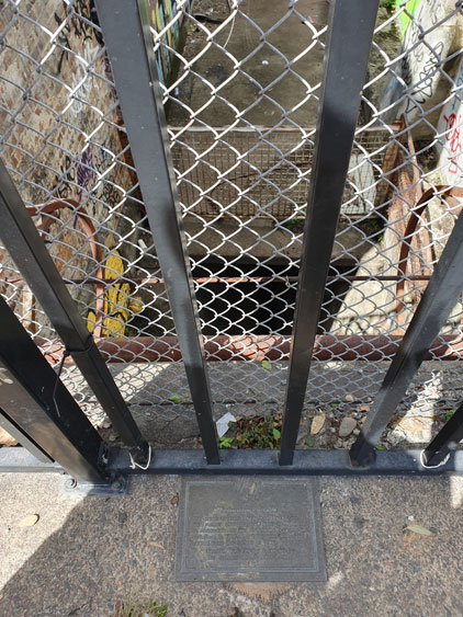
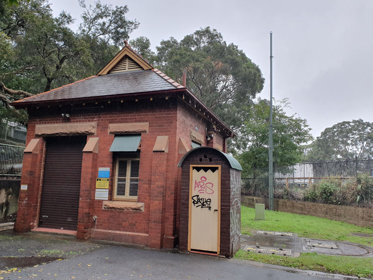
The Man Who Walks Ahead drops me at Smith & Spindler Park and will this time drive ahead to meet me at Tramsheds. Before I set off I am drawn to a cluster of small brick building in the corner of the park. It is another Sewage Pumping Station, SPS 4. I am surprised to find the high chain wire gate ajar and I walk right into the compound, as have many graffitists before me. There is an outdoor dunny attached to the main building and inevitable jokes spring to mind. Is it connected to the sewer, I wonder. When I tell him about it later The Man suggests it might house a relief valve.

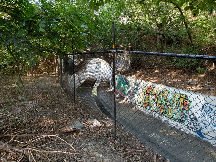
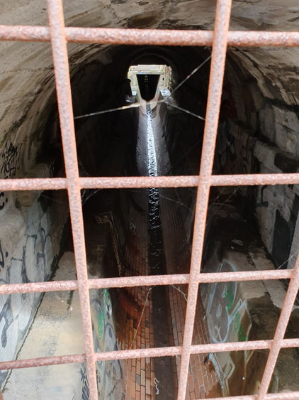
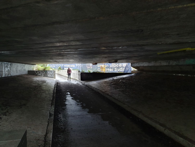
There is a steep dip in the claustrophobic tunnel under The Crescent. A friend later tells me that when she used to cycle home from Glebe she would have to take a long detour whenever Johnstons Creek flooded because the water in the underpass was too deep to ride through.

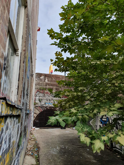
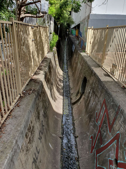
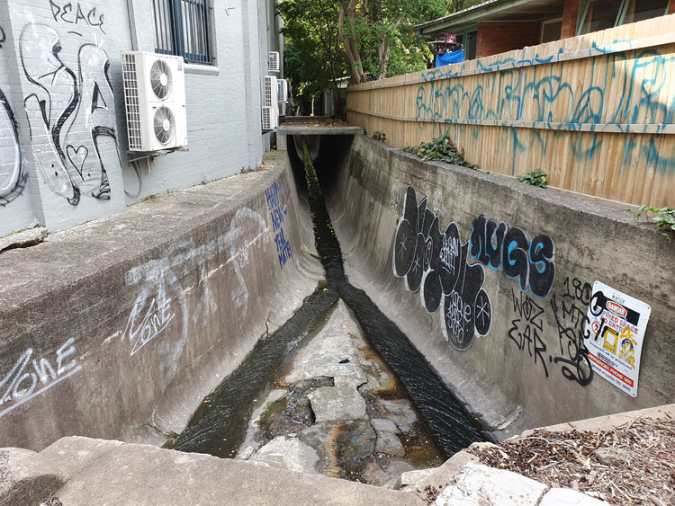
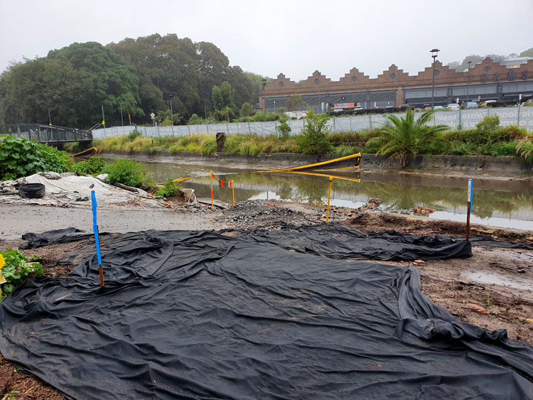
When I emerge I’m disappointed to find the creek blocked from view by safety fencing and Sydney Water banners. ‘Johnstons Creek naturalisation’, they read, ‘We’re improving the health of this waterway, creating a better place for the community to enjoy’.  I peer through a gap in the screens and conclude that things have got a lot worse before getting better.  It was in this stretch of the canal that a confused bull shark, said to be 1.8 metres long, was stranded in a pool when the tide went out one day in September 2009. Happily it escaped back to Rozelle Bay when the tide came in.

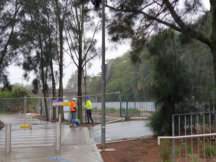
I am now in Federal Park. Larger than all the other parks and reserves that edge the western  side of Johnstons Creek, narrow Federal Park runs all the way from here to the bay.  At a place where two separate bridges cross the canal (one for vehicles, one for pedestrians) two men in high-vis jackets are earnestly discussing ground water and surface water. Beyond them I can see the rail viaduct.

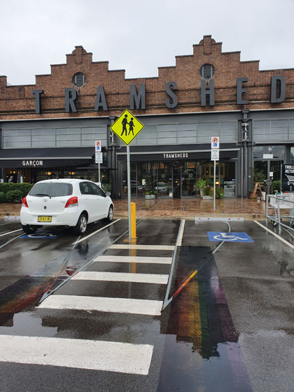
When I walk under the viaduct I will have completed the whole length of Johnstons Creek proper. But that walk must wait for another day. Right now The Man is waiting in the carpark of Tramsheds, where the former Rozelle Tram Depot has been transformed into an eating emporium.  Erected in 1904 and preserved by repurposing, the depot was one of several imposing infrastructure projects built near Johnstons Creek around that time including, of course, the canal itself.

If there aren’t too many people we will be allowed to sit at a café for a cup of coffee rather than having to buy takeaway.  It’s still raining but a rainbow has come out.

Concrete Creeks. Excursion 8. The tunnel of love.

Wednesday 22 April 2020

Today we pick up where we left off just a few days ago at Chester Street footbridge, to see if it’s possible to walk beside Johnstons Creek canal as far as Booth Street. We find there is public access behind houses but the ground is rough and covered with leaves from overhanging trees. Garden rubbish tossed over from backyards, most of it large palm fronds, makes the going tougher. Mosquitoes are biting in the shade but ahead the canal makes an elegant S-curve and, backlit by the autumn sun, the arch under Booth Street becomes a Tunnel of Love.

We scramble up to the roadway via another mini-reserve, this one called Badu Park. Cyclone fencing, orange plastic barriers and a roadside port-a-loo signal that the bridge is a construction site. It’s being widened, the notices on the fences say, and will have better footpaths and a bike path. Hopefully the two present-day councils responsible came to an agreement about who paid for what without the years of bitter feuding and name-calling that went on between Leichhardt and Camperdown Councils when the present bridge was built around 1898 to replace an old wooden bridge.

Beside the canal where it emerges from under the bridge there is a quaint brick and sandstone Federation-style building, partially hidden by trees and fences. It’s SPS 3 or, as I later confirm from Sydney Water’s heritage listings, Sewage Pumping Station No.3 built around 1901.

To get a better look at SPS 3, I walk down a stump of a road and across a small bridge below the level of Booth Street. From here I can also see where the canal continues around a bend before it is joined by Orphan School Creek near Wigram Road. That confluence was the location for one or our earlier excursions.

This is as far as we are going today. There’s a café nearby but if we want coffee we must line up in an orderly and properly distanced queue.

Postscript. By coincidence, in the following morning’s Sydney Morning Herald there’s an article about a $20 million scheme to upgrade small public spaces in Sydney’s inner west. One of the projects is a shared pedestrian and cycle path to be constructed along Johnstons Creek from Wigram Road to Chester Street. That’s the same rocky route we have just taken. Soon there will be no tossing of dead palm fronds over back fences.

Concrete Creeks. Excursion 4. Deep water.

Friday 27 March 2020

For the fourth of our piecemeal visits to Johnstons Creek we return to Parramatta Road and plunge into the narrow streets on the northern side where a light industrial triangle is squeezed between the creek and Pyrmont Bridge Road. The streets slope down to a concrete pathway that covers this section of the canal. We turn left and find ourselves at the sandstone bridge on Parramatta Road, where thousands of cars pass Stanmore McDonald’s every day. The creek traces a silvery line through the shadows under the road.

Turning around to follow the flow of the creek we walk between the backs of properties, respectable Victorian houses on one side, factories and derelict houses on the other. The path comes to an abrupt end at a metal grate and fence. Beyond is a deep channel of coolness where we can hear the creek falling. A bird calls from somewhere in the overhanging shrubbery.

We scramble up into a grassy area at the foot of Water Street. I will later read a lengthy real estate advertisement from 1850, when the farm here was subdivided into housing allotments. This grassy area is described as “a RESERVED WATERING PLACE at deep water on Johnstone’s Creek [that] will add materially to the comfort of the occupants”. There are still some residences in Water Street as well as warehouses and the last house before the reserve has a small but unusual garden.

Walking back to the car I spot an abandoned shopping trolley and for a moment think I have come upon a cache of toilet paper.  But no, the cartload only consists of styrofoam packaging cylinders.

Concrete Creeks. Excursion 2. Where waters meet.

Saturday 21 March 2020

I have moved a short way upstream for today’s visit to Johnstons Creek. After inspecting the canal where it passes deep under Parramatta Road I am tracing it backwards and find that the next available viewing point is in a Stanmore street cut in half by the canal. A pedestrian bridge joins the two halves. The concrete waterway is flanked by factory walls on one side and backyard gardens on the other, whose overhanging trees hide shady secrets. ‘Call Your Mum’, urges a graffiti message. We set off to find what’s around the corner further upstream.

The streets in this commercial/industrial area are hot and lonely as if it were a Sunday afternoon but we are distracted by a café, open perhaps for one last day. Cautiously practising our new social distancing skills we order then sit out in a courtyard surrounded by closed studios and workshops that barricade us from the canal.

One last push on to Salisbury Road and I find what I’m looking for. This is where Johnstons Creek emerges from beneath its permanent suburban cover.  Surprisingly there’s another large drain that joins it. It’s time to go home and study old maps to find the sources of the creek and this underground tributary. They don’t always form such a lazy trickle. I’m later told that trainee volunteers with the local SES are brought here on ‘flooding hot spot tours’.

This week I was reminded that Sydney’s supreme suburban explorer, Vanessa Berry, has already tracked Johnstons Creek on her Mirror Sydney blog. Different eyes. We will compare notes next time we meet, whenever that might be. ‘Happy New Year Mate’ wishes another graffiti message in blue paint. Anxious strange year is more like it.

Concrete Creeks. Excursion 1. The sandstone bridge.

Thursday 12 March 2020

It is the beginning of social isolation and I have devised a plan that involves, not staying in, but getting out into the customarily deserted streets of suburbia. To keep me exercised and interested, but distanced, I will try tracing the paths of local waterways, most of them now hidden underground or confined to canals that lurk around back lanes. My Journal of the Plague Year will document a watery wander.

I start with Johnstons Creek, a notable watercourse on the inner western fringe of central Sydney.  It is named after Lieutenant George Johnston, who arrived as a marine on the First Fleet in 1788. Within a few years of the colony being established Johnston was granted a parcel of land and this creek formed the eastern boundary of his property.

My first excursion takes me to Parramatta Road, which crosses Johnstons Creek part the way along its course. Peering over a railing I can see the creek still flowing way down in the bottom of its ovoid stormwater canal. Before writing up this journal entry I learn from someone close to me that her graffiti crew used to spray here. But that was many years ago. I doubt there’s anything of hers visible now.

A Bicentennial plaque set into the concrete footpath tells me that a wooden bridge was built here in 1839. There are remnants of a subsequent sandstone bridge on the other side of Parramatta Road. More graffiti, including the name of a well known street artist who’s just recently been charged with sexual assault.

Tunnel crossing

Tunnels are favourite locations for graffiti, not only tags and ‘writing’ but also creative — though unofficial –  public artworks. The ephemeral nature of these makes them more interesting than the durable commissioned murals that are sometimes painted or tiled on tunnel walls. However charming or sophisticated the official works might be, they can become boring for people who pass that way day after day.

In Antwerp there is a pedestrian tunnel underneath the railway line between Centraal Station and Berchem. It has several artworks painted, pasted or projected on the walls, floor and even the ceiling.

13n-ncP1020988_TunnelRide

Naturally I like the zebra crossing, given my interest in the symbolism of crosswalks. Perhaps, given the amount of bicycle and even motorcycle traffic in the tunnel, the artist had in mind that pedestrians needed assistance to cross safely from one side to the other, should they wish to do so. Or perhaps the artist wanted to encourage people to go against the flow, although going against the flow in this case would only bring you up against a brick wall.

13n-ncP1020983-TunnelWalk

My thanks to Duncan, a fellow participant at the Visual Methods Seminar at the University of Antwerp, for finding this pedestrian crossing for me. Thanks also to Alan for demonstrating the use of the crossing for the photo.

Tunnels

Piss Alley, Enmore/Newtown (Sydney), 2010

There is light at the end of the tunnel, I’ve rounded the turn, I’m on the final leg, the end is in sight, I’ve entered the home straight. I’ve also just about reached the end of my tether.  But huzzah! There is a definite possibility that I will finish this PhD project. I just have to polish the Pavement Appreciation website for you to have a look at, re-write a few chapters of the thesis, knock the bibliography into shape … well, it might take a couple more months yet, but I’m nearly there.

To celebrate this moment of optimism I am posting some of my pictures of graffiti on the floor of tunnels. I also have a few photos of wonderfully inventive graffiti on tunnel walls, made without the benefit of spray-can or paintbrush, but maybe I’ll save them for another time.

Graffiti Tunnel, Waterloo Station, London, 2010


Pedestrian underpass at Petersham Station (Sydney), 2009