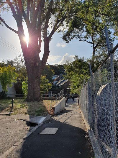
Another lockdown. A new walking project. I’m still fixated on Johnstons Creek, but this time I’m following the rim of its catchment area, a route that will take me along the ridges of Petersham, Stanmore and Annandale. And that is as far as I will get while restricted to my local government area.
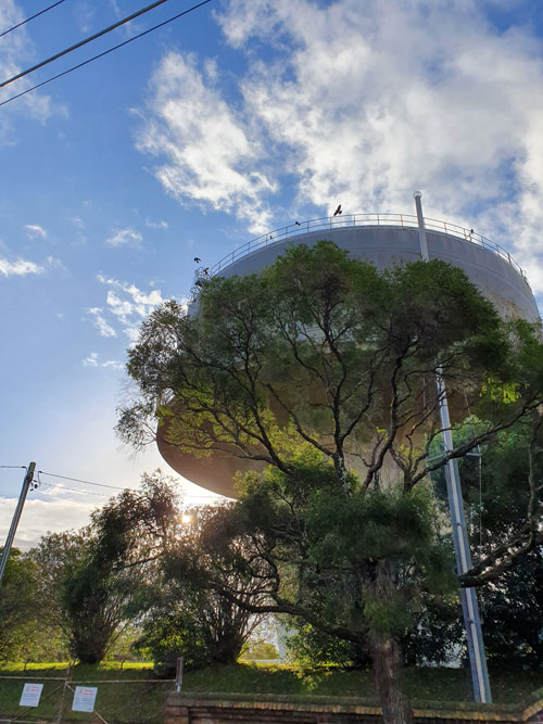
I begin at the highest point west of the Sydney CBD before the Blue Mountains. You might call it Sydney’s upper inner west. It’s right where the landmark Petersham Water Tower is poised – this heritage-listed, concrete engineering marvel. This afternoon a group of currawongs is enjoying the rim of the tower and its updrafts.
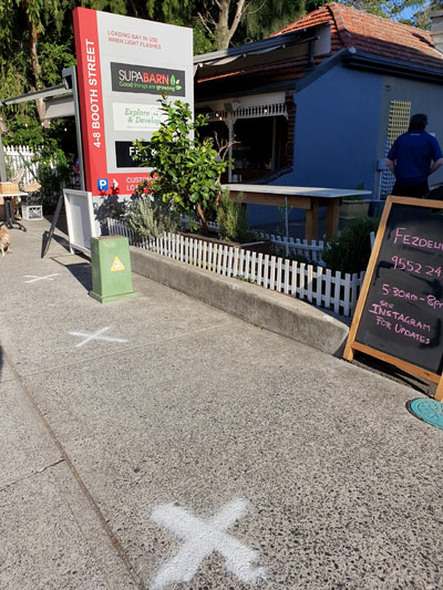
Using Sydney Water’s stormwater catchment map, detailed down to individual blocks of land and house numbers, I head north along Crystal Street, stopping to turn around and photograph a relic of traffic signs past. It’s a ‘SLOW’ warning written in metal studs on the concrete. I manage to photograph it (not for the first time) during a traffic light-induced gap between vehicles.
Where Crystal Street crosses the railway line I am still on high ground. From the bridge you are supposed to be able to tell if it is snowing in Oberon, on the other side of the Blue Mountains. My friend who lives there says I should look for a green cloud. Today there is no faraway green cloud but I do catch late afternoon shafts of light.
The perimeter of the Johnstons Creek catchment area, as it is indicated on the Sydney Water map, is sometimes curved in places where old roads have followed natural ridges. But more often it becomes a series of straight lines at angles to each other, where streets have been laid out in a grid that disregards topography. In those places the map outline fudges the lie of the land in order to conform to the alignment of streets, lanes, buildings or water pipes.
I turn east off Crystal Street but come to a point where the map line darts between two houses. Since I can’t walk through people’s property (nor am I physically able to climb over back fences) I must backtrack and walk all the way round to meet the imaginary line in the next street parallel. I can see that this is going to happen over and over again on my series of excursions.
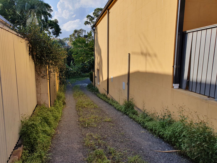
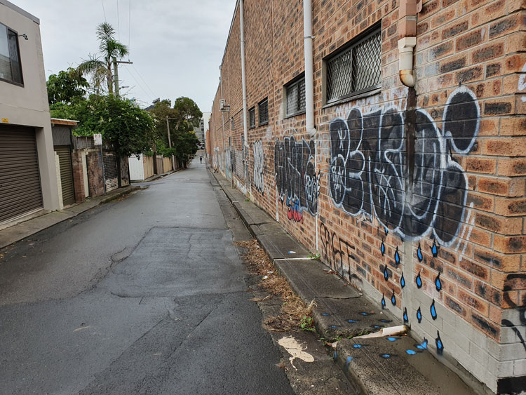
The last part of today’s trip takes me through some disappointing back lanes. In this neat part of Petersham there are wheelie bins in the lanes but no piles of discarded junk for me to cast my eye over, only the occasional mystery abandonment. It is starting to rain and I turn back.
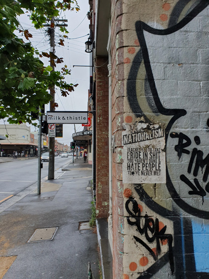
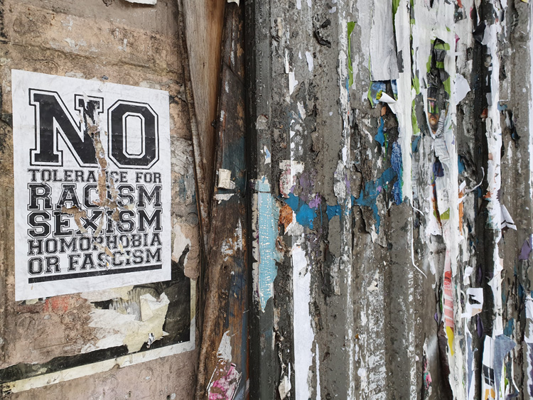
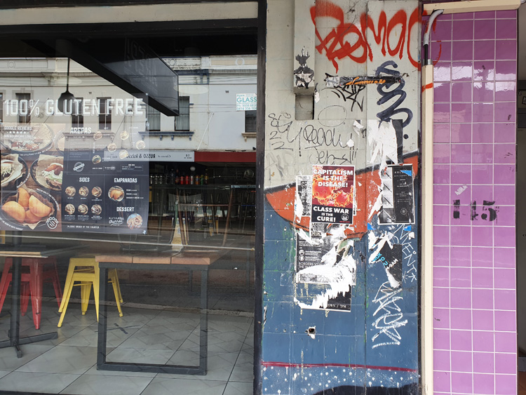
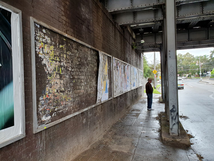
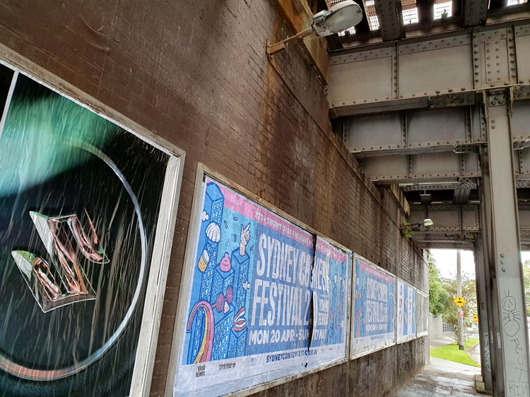
Despite galloping gentrification, the Newtown-Enmore ‘destination precinct’ of Sydney’s inner west retains remnants of its former underground student activism, most notably in the form of fly-posters promoting leftist and anarchist causes.
Bill posting is illegal, with the local Inner West Council defining posters as ‘visual pollution’, along with other forms of ‘unwanted graffiti’. However, unlike the City of Sydney, which administers the north-eastern end of Newtown, the Inner West Council does not carry out an aggressive program of graffiti and poster removal. This might mean the Inner West has a smaller budget for street beautification, but over the years I have come to realise that it also indicates an uneasy tolerance on the part of Council, and that this tolerance is based on ambivalence.
Inner West Council trades on the image of Newtown-Enmore as a ‘vibrant’ and edgy area where there is always something to see and do. Its arts program, tellingly named EDGE, seeks to reinforce the area’s position as ‘the cultural engine of global Sydney’. It is noteworthy that the 2019 EDGE program was themed Art and Activism and that it included works of pseudo-graffiti, such as a series of giant paste-up illustrations celebrating the Reclaim the Streets activist movement, and trails of animal stencils on footpaths described as a ‘guerrilla pavement art project bearing witness to The Sixth Mass Extinction’.
With this kind of endorsement of graffiti and paste-ups it’s not surprising that unauthorised fly-posters have become an intrinsic element of Newtown-Enmore’s cultural capital. Political posters draw attention to the locality’s history as a seat of activism and this history is encouraged by Council’s arts programs to be regarded as an element of cultural ‘heritage’.
This blog post is an edited excerpt from:
HICKS, M. (2021) Flyposter graffiti and the change in a Sydney streetscape during the time of COVID-19. Visual Studies, 36, 141-146.
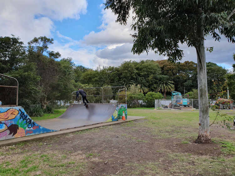
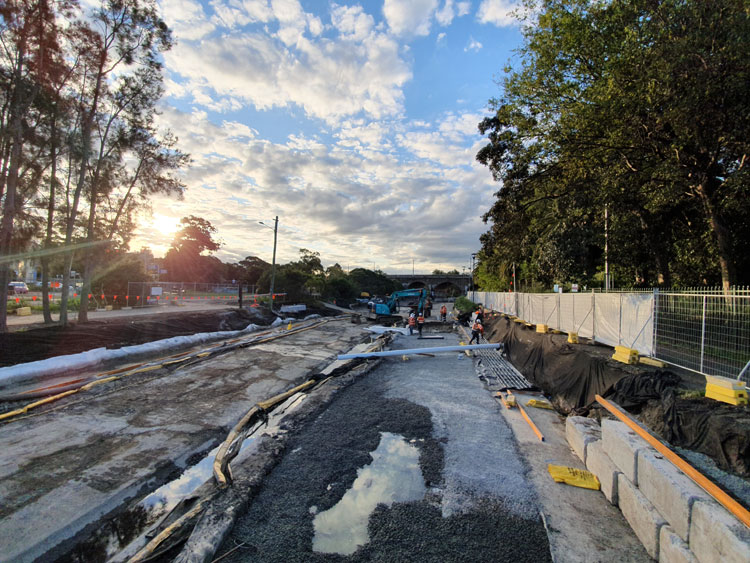
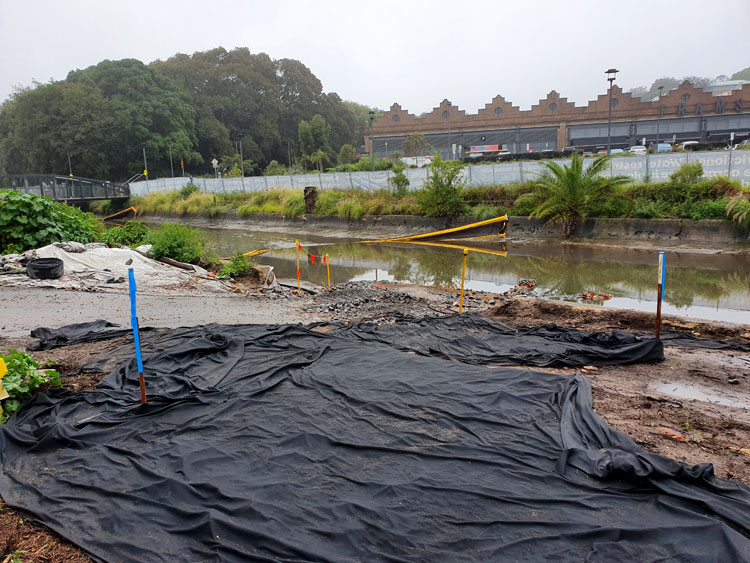
For this last journey along Johnstons Creek we take a path not far from Tramsheds, but on the opposite side of the canal. To follow the concrete line of the canal towards Rozelle Bay, we begin beside a skate ramp and an assembly of earth movers standing by to work on Sydney Water’s ‘naturalisation’ project.
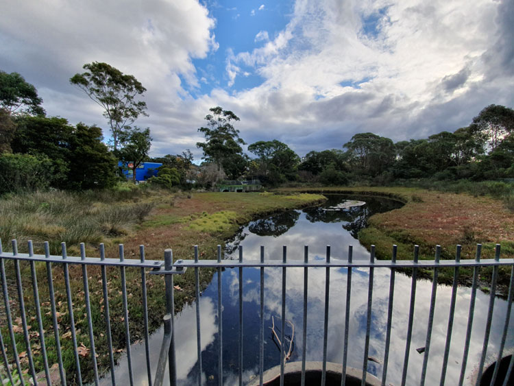
Not far along the sandy path I am surprised to see a reed-fringed pond with a signboard, ‘Federal Park Wetland’. The sky to the north is threatening, but above us there are blue patches and their reflections match the colour of the pet supplies barn beyond the trees. Overflow from the pond empties into two basins and, on the other side of the path, we see that it has run underneath us to the canal.
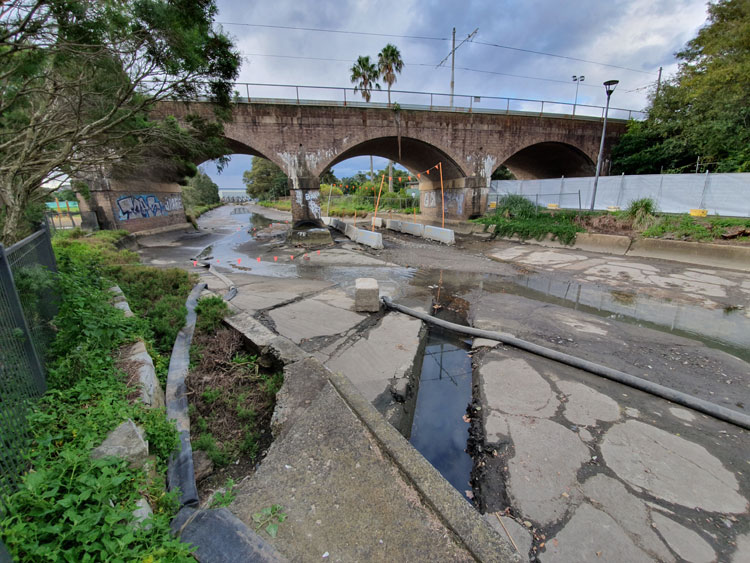
The tide is out, or perhaps it was prevented from coming in. The canal is dishevelled, strewn with pipes, barricades and building site paraphernalia. Water pumped from somewhere upstream pours from a large black hose. This scene is so different from the almost-idyllic autumnal waterway that we looked back on from the sunny Glebe foreshore in April.
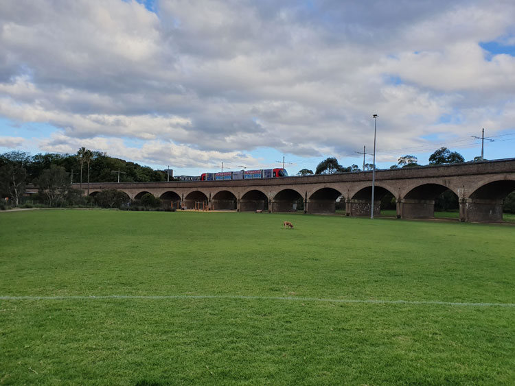
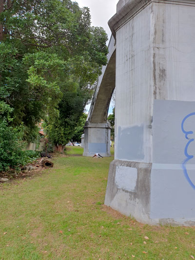
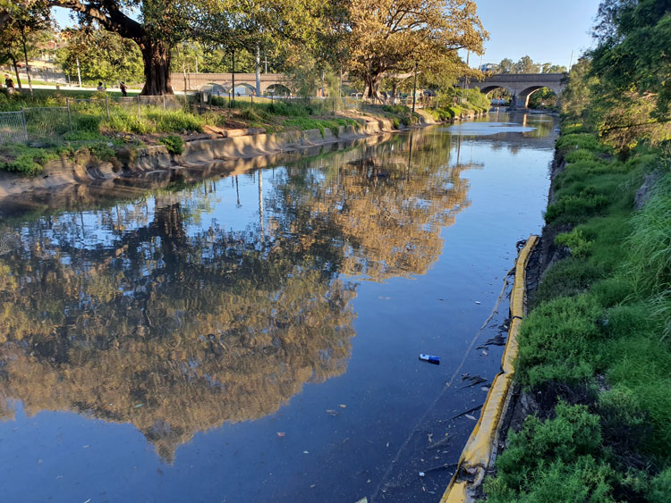
The rail viaduct is the next landmark. Built to carry steam trains taking goods to and from Darling Harbour, it has since been modified with overhead electric wires for the Metro light rail. From where Federal Park has widened out into a grassy but soggy playing field we can look back and admire its elegant curve and graceful brick arches.
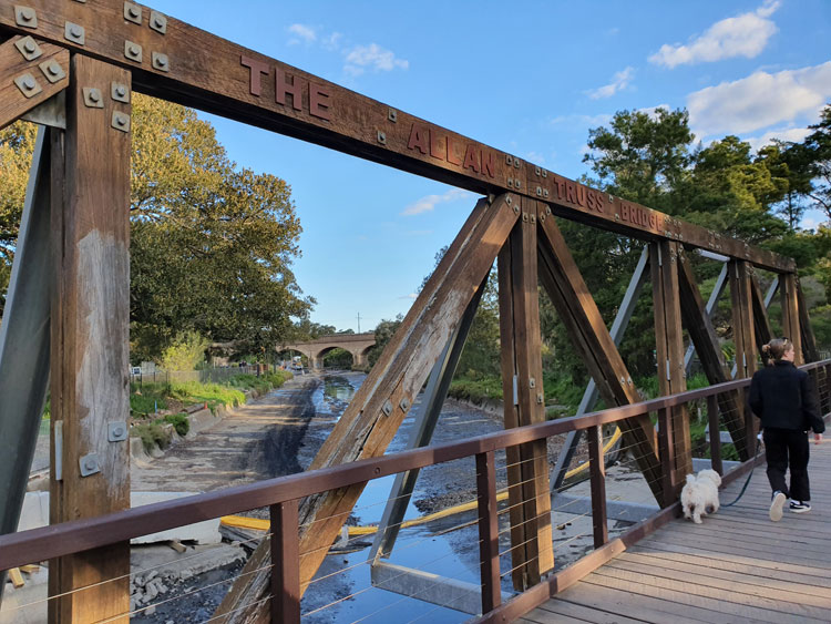
Further on, after stepping along a temporary plastic path between safety fences, we arrive at the feted and recreated Allan Truss Bridge. This is the spot where we abandoned our foreshore outing in April, which means we have completed our piecemeal exploration of Johnstons Creek proper, from drain to bay. Over the weeks we have encountered twelve bridges across the canal, passed under two mighty viaducts, and walked over countless hidden feeder pipes and drains.
The characteristic salty-muddy smell of a tidal flat accompanies us as we cross the truss bridge. On the other side a large section of Bicentennial Park has also become a reconstruction site, where hard hats must be worn and 1.5 metre distancing observed.
We now return to where we started today, this time taking a route along the eastern side of the canal between more wire safety fences and the trim white picket fence of Jubilee Oval.
Back at the two bridges that cross from The Crescent in Annandale to Harold Park and the Tramsheds food mall in Forest Lodge, I look upstream towards the vast residential development that has replaced the Harold Park Paceway. Before embarking on this last Johnstons Creek excursion I have done some reading and I now realise that this whole area is a broad, flat valley. Although there are acres of open space, nothing is orginal. Not the concrete-confined creek, nor the planted reed beds and grassy slopes in front of me. Behind me, not the little wetland, the tidy playing fields and parks, the Indian mynahs splashing in the canal, nor the neatly walled edges of Rozelle Bay. Not even the trees.
In this valley Johnstons Creek once stretched out as a wide estuarine wetland with tidal mudflats and mangrove thickets, but in the 19th century the valley was filled with spoil from elsewhere in the curiously misnamed process of reclamation.
Over the generations since then, various organisations and departments have argued and compromised and acted to shape the land to their various needs and wants – grassy parklands and avenues of trees, factory sites, warehouses, timberyards, tramyards and a racecourse. Similar wrangling has characterised more recent efforts to restore fragments of the ‘reclaimed’ valley to a semblance of its former self.
So we have reed beds adjacent to a high-rise development, an artificial wetland fed by real runoff, newly planted patches of native vegetation (some already infiltrated by exotic weeds), and a corner of mangroves in an area small enough that it doesn’t encroach on open space. The latest change is Sydney Water’s grand naturalisation project which includes, among other things, replacing the concrete banks of the canal with sandstone and native plants, and expanding the salt marsh around it. The City of Sydney’s concurrent scheme to improve The Crescent and Federal Park will feature less natural works, like a skate plaza and picnic areas with barbecues.
During my walking and reading explorations I have been disappointed not to find specific references to pre-20th century Aboriginal people who might have frequented the immediate environs of Johnstons Creek. Recently written descriptions and histories of the surrounding suburbs usually begin with the obligatory generalised nod to the Cadigal and Wangal people of this area before getting on with the ‘real’ history. But even in serious accounts I have found no mentions of these people that can be pinned specifically to Johnstons Creek, nor can I find any stories handed down through generations, or contemporaneous mentions of Aboriginal people being seen here, or any records of archaeological discoveries.
It stands to reason. The region now covered by the suburbs of Stanmore, Camperdown, Annandale and Forest Lodge was very close to the original colonial settlement of Sydney, so even before the very early land grants were made here, most Aboriginal people had probably gone. During the subsequent periods of farming, subdivision and urbanisation, any traces of the original people would have been dug up, buried, built over or wilfully ignored.
Still, there is enough evidence from nearby or similar areas to suggest how these people lived. They might have hunted in what the colonists called the ‘Kangaroo Ground’ where Johnstons Creek rose. The might have accessed its fresh water. They would have probably frequented the sandstone ridges of now-suburban Glebe overlooking the estuarine valley, staying in overhangs like the rock shelters with associated middens that have been found not so far away in Lilyfield and Birchgrove.
They would not have lived in the watery valley but almost certainly foraged there, just as people did in the long-ago ‘reclaimed’ Blackwattle Bay on the other side of Glebe Point, where archaeologists have recently uncovered several deposits of stone artefacts. Glebe historian Max Solling says there is ‘some evidence of Aboriginal middens – the remains of shellfish – in the narrow strip of remnant salt marsh fringing the lower parts of Johnstons Creek. The ark cockle, scallop and Sydney rock oyster and mud whelk found there indicate that this was a fertile swamp and a rich source of food for the first inhabitants’.
As this stage of my Covid-19 isolation project comes to an end social restrictions in New South Wales have been eased. I am not sure that I could muster the number of friends I am allowed to mingle with, but later in the week we are having lunch with two friends. They are volunteers with the State Emergency Service and so are interested in previous waterways and potential flood zones. Perhaps we will talk about the buried tributaries of Johnstons Creek that I have yet to explore. I want to hear more of their stories about local streets that turn into torrents, and basement pumps, and flooded police cells.
References:
Attenbrow, Val, Sydney’s Aboriginal past: investigating the archaeological and historical records, UNSW Press, 2010.
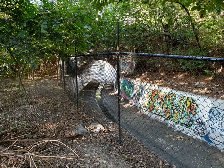
At the northern end of Smith & Spindler Park in Annandale there is a quaint arched footbridge across to AV Henry Reserve. After passing beneath this footbridge Johnstons Creek flows under a road bridge where vehicles swoop around the arc of The Crescent. The canalside pathway has a separate underpass below the road. I have chosen to follow this section of the canal on a rainy weekday in the hope of avoiding encounters with speeding cyclists on the shared path. I am the kind of pedestrian they hate – slow, meandering, crossing unpredictably from one side of the path to the other to take photographs.
The Man Who Walks Ahead drops me at Smith & Spindler Park and will this time drive ahead to meet me at Tramsheds. Before I set off I am drawn to a cluster of small brick building in the corner of the park. It is another Sewage Pumping Station, SPS 4. I am surprised to find the high chain wire gate ajar and I walk right into the compound, as have many graffitists before me. There is an outdoor dunny attached to the main building and inevitable jokes spring to mind. Is it connected to the sewer, I wonder. When I tell him about it later The Man suggests it might house a relief valve.
There is a steep dip in the claustrophobic tunnel under The Crescent. A friend later tells me that when she used to cycle home from Glebe she would have to take a long detour whenever Johnstons Creek flooded because the water in the underpass was too deep to ride through.
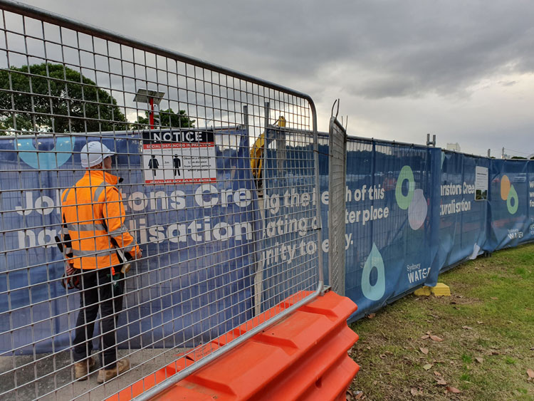
When I emerge I’m disappointed to find the creek blocked from view by safety fencing and Sydney Water banners. ‘Johnstons Creek naturalisation’, they read, ‘We’re improving the health of this waterway, creating a better place for the community to enjoy’. I peer through a gap in the screens and conclude that things have got a lot worse before getting better. It was in this stretch of the canal that a confused bull shark, said to be 1.8 metres long, was stranded in a pool when the tide went out one day in September 2009. Happily it escaped back to Rozelle Bay when the tide came in.
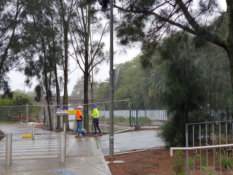
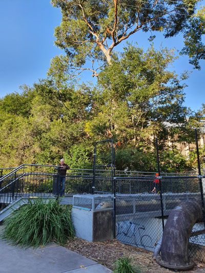
I am now in Federal Park. Larger than all the other parks and reserves that edge the western side of Johnstons Creek, narrow Federal Park runs all the way from here to the bay. At a place where two separate bridges cross the canal (one for vehicles, one for pedestrians) two men in high-vis jackets are earnestly discussing ground water and surface water. Beyond them I can see the rail viaduct.
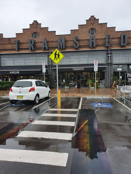
When I walk under the viaduct I will have completed the whole length of Johnstons Creek proper. But that walk must wait for another day. Right now The Man is waiting in the carpark of Tramsheds, where the former Rozelle Tram Depot has been transformed into an eating emporium. Erected in 1904 and preserved by repurposing, the depot was one of several imposing infrastructure projects built near Johnstons Creek around that time including, of course, the canal itself.
Johnstons Creek would have once been a pretty little bushland waterway but when the surrounding land was subdivided, houses and factories turned their backs on it. In 1838 it was described as ‘that invaluable stream of water’, but by 1892 it was condemned as a ‘fever bed’ with calls to commence the building of a canal because of the creek’s ‘menace to public health arising from the sewage nuisance’.
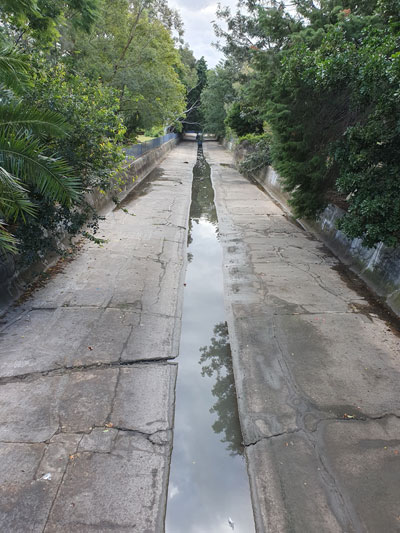
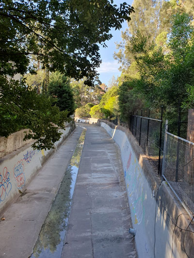
Our excursion this weekend takes us from one of the worst of those ‘nuisance’ areas at Wigram Road, to The Crescent in Annandale, and back again. The canal that was eventually built is wide but water is only flowing in the central gutter today. Signs warn us that this is a Flood Zone, so I’ll be back next time the weather is wild.
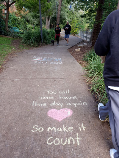
On either side of the canal is a string of tiny parks and reserves, each named separately, presumably as a way of keeping up with the backlog of municipal worthies who deserve recognition. In Canal Reserve we walk over several cheesy homilies neatly written in coloured chalk.
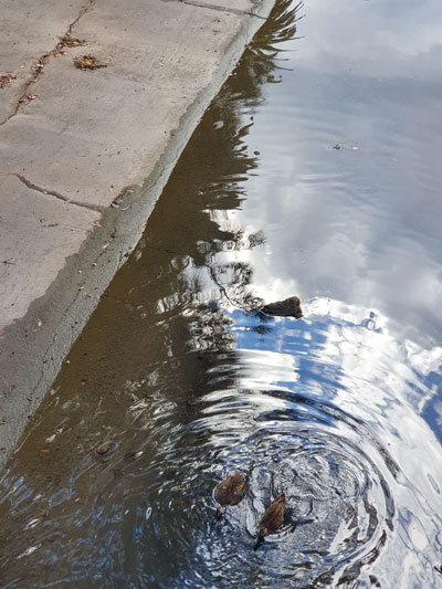
Beside JV McMahon Reserve we watch a pair of ducks emerge from where they have been dallying beneath a footbridge.
Near Minogue Crescent Reserve we see a woman practising solitary Twister beneath the arches of the area’s most impressive landmark, the Johnstons Creek Sewage Aqueduct.
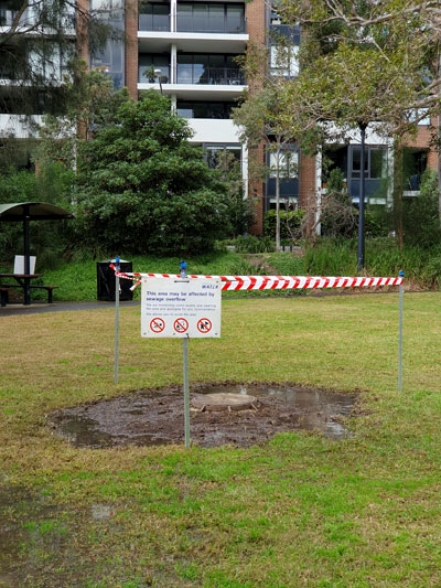
In AV Henry Reserve there is a bubbling spring in the centre of a swamp which, a notice informs us, may be affected by sewage overflow.
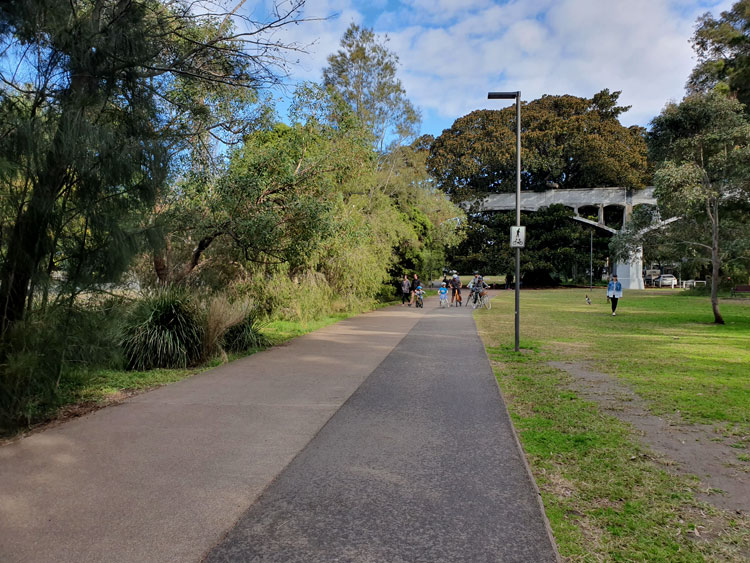
We cross the creek by walking over the road bridge at The Crescent, then turn back and descend into Smith & Spindler Park where, with its wider grassy sward and smoother path, we now encounter the dreaded joggers, spandex cyclists, whole families on wheels, and off-leash dogs. We notice that a children’s playground has been reopened just this week.
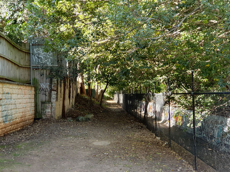
To our left is the canal which, for some reason, has been blocked from view by a dense planting of casuarina trees. To our right, beyond the grass, is Nelson Lane, currently decorated at regular intervals with piles of discarded domestic ware, the product of lockdown busy-ness.
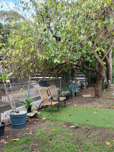
Our limbs still intact and our lungs too, we hope, we press on back to Wigram Road, via the narrower Hogan Park, where a town house dweller has annexed public space outside their back gate to create a canalside pleasure dome complete with outdoor chairs, a swing, pot plants and plastic grass.
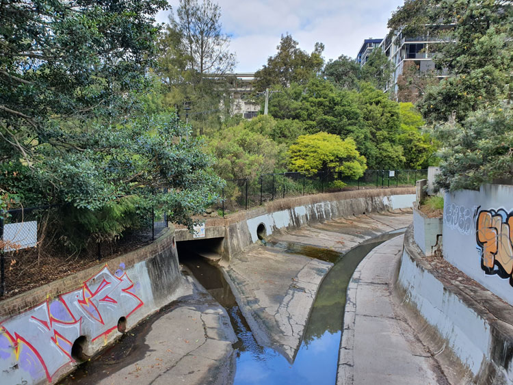
Today we pick up where we left off just a few days ago at Chester Street footbridge, to see if it’s possible to walk beside Johnstons Creek canal as far as Booth Street. We find there is public access behind houses but the ground is rough and covered with leaves from overhanging trees. Garden rubbish tossed over from backyards, most of it large palm fronds, makes the going tougher. Mosquitoes are biting in the shade but ahead the canal makes an elegant S-curve and, backlit by the autumn sun, the arch under Booth Street becomes a Tunnel of Love.
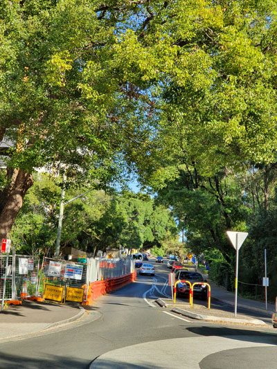
We scramble up to the roadway via another mini-reserve, this one called Badu Park. Cyclone fencing, orange plastic barriers and a roadside port-a-loo signal that the bridge is a construction site. It’s being widened, the notices on the fences say, and will have better footpaths and a bike path. Hopefully the two present-day councils responsible came to an agreement about who paid for what without the years of bitter feuding and name-calling that went on between Leichhardt and Camperdown Councils when the present bridge was built around 1898 to replace an old wooden bridge.
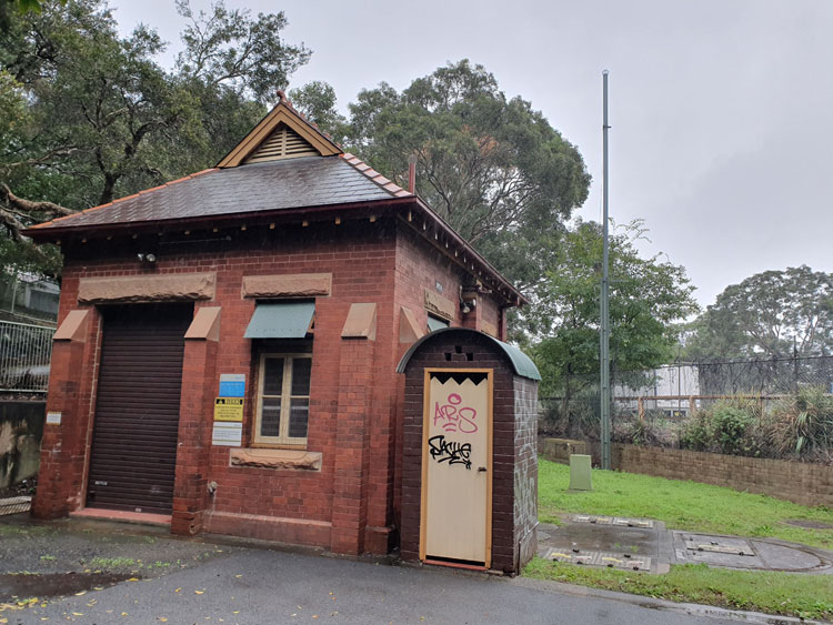
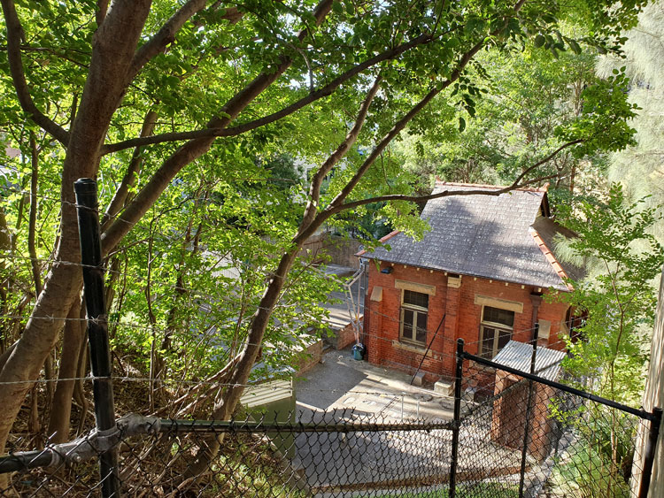
Beside the canal where it emerges from under the bridge there is a quaint brick and sandstone Federation-style building, partially hidden by trees and fences. It’s SPS 3 or, as I later confirm from Sydney Water’s heritage listings, Sewage Pumping Station No.3 built around 1901.
To get a better look at SPS 3, I walk down a stump of a road and across a small bridge below the level of Booth Street. From here I can also see where the canal continues around a bend before it is joined by Orphan School Creek near Wigram Road. That confluence was the location for one or our earlier excursions.
Postscript. By coincidence, in the following morning’s Sydney Morning Herald there’s an article about a $20 million scheme to upgrade small public spaces in Sydney’s inner west. One of the projects is a shared pedestrian and cycle path to be constructed along Johnstons Creek from Wigram Road to Chester Street. That’s the same rocky route we have just taken. Soon there will be no tossing of dead palm fronds over back fences.
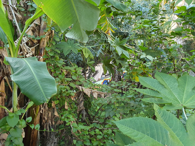
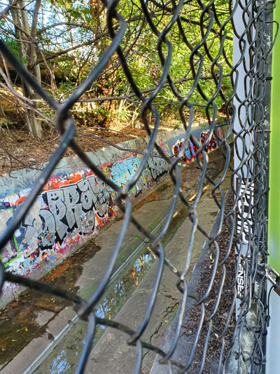
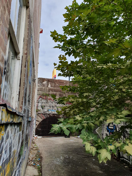
It’s over three weeks since we visited this light industrial triangle between Johnstons Creek and Pyrmont Bridge Road. There have been other excursions in between but now I’m back to find out what happens to the creek beyond the forbidding metal fence where it drops into an open canal behind Water Street. Just a few neatly kept little houses remain here, tucked between hulking factories and warehouses, and we have come on a Sunday hoping to avoid large trucks squeezing into delivery bays. I walk down a driveway between two houses in Water Street and find that it opens onto a gravelled space bounded on three sides by buildings and on the fourth by a thick jungle of banana trees, castor oil plants, convolvulus and asthma weed. With no machete available I can only peer down the steep slope for glimpses of the canal wall, recognisable by its symbiotic graffiti.
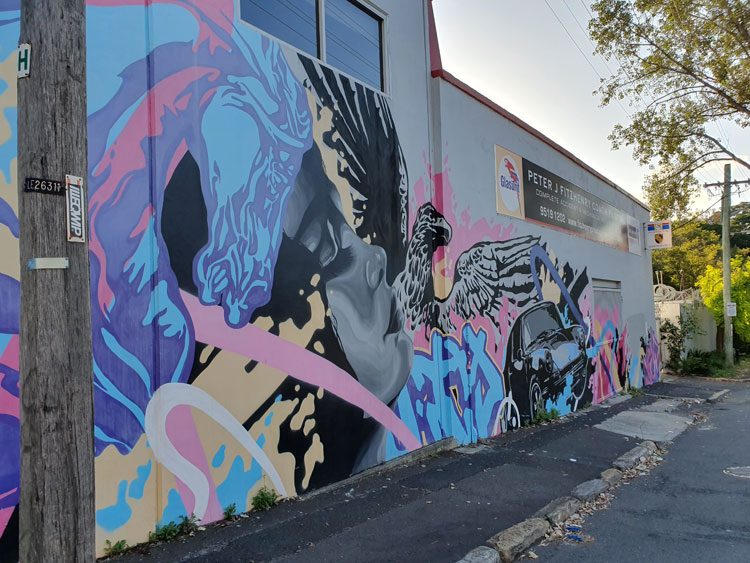
Frustrated by the banana jungle we move east to a wider industrial street that leads directly down to the canal. I have never been on Chester Street before but later I will read that there was once a household garbage tip amongst the houses on this side of Johnstons Creek. It was the source of much friction between the adjoining boroughs of Camperdown and Annandale in the late 1800s. For fifteen years countless newspaper column inches were taken up with reports of council meetings and letters to the editor on the subject of the Camperdown tip, whose ‘deadly effluvia’ made the creek filthy and ‘endangered the lives of the residents of North Annandale’. There are no houses here now and no tip. Instead there is a motor repair business with a wild piece of wall art.
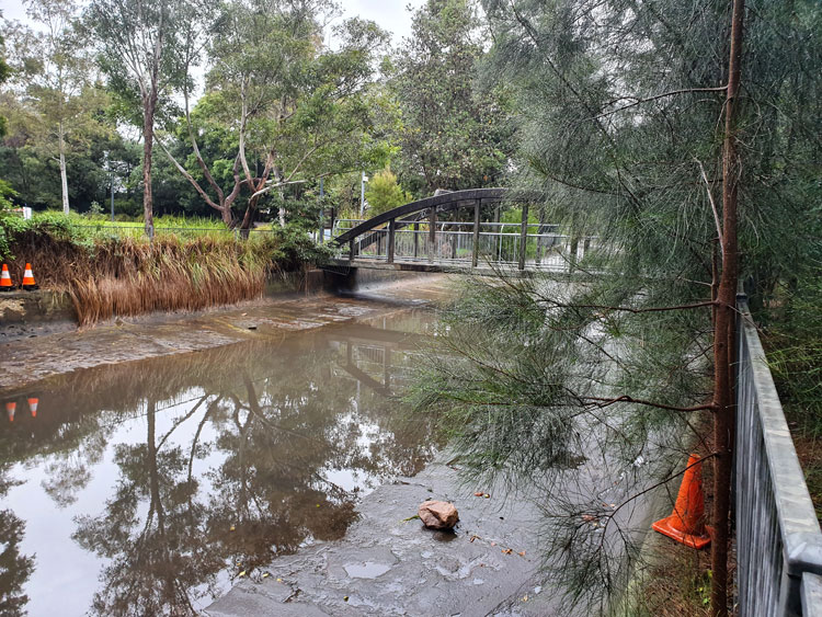
We walk down the hill to a newly-built footbridge over the canal. On the other side of the dip the street climbs up between the Federation houses of re-gentrified Annandale.
Everything here looks new, but the two playgrounds are roped off to prevent children from disobeying social distancing rules. This tiny canalside reserve is called ‘Douglas Grant Memorial Park’ in honour of an Aboriginal man whose original name was Ng:tja. The survivor of a massacre, in 1887 he was taken as a toddler from his North Queensland home thousands of kilometres away and brought up in Annandale as a member of his captor’s family. His story is told on two plaques. It does not end well.
By taking a short walk along where this narrow park skirts a series of backyard fences, I can look across to the place where I had earlier tried bush-bashing. The clear band of water that I couldn’t see from the other side reflects the sky, but the graffiti is old and dilapidated, as if the renovation of the area has made the canal too public for spray painters.
This nook in Annandale is a revelation to me. But not to locals of course. Not the cyclists and joggers intermittently crossing the bridge. The two young men casually shooting a basketball. The squealing children doing wheelies on their scooters. Nor the three teenagers sitting at a picnic table and idly chatting not quite 1.5 metres apart.
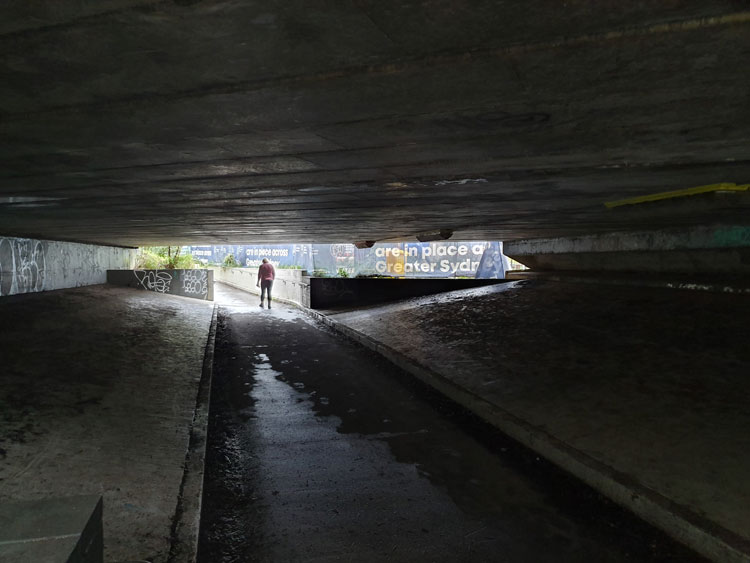
It is raining lightly and the urban currawongs are going joyously berserk as we set off. Having visited the mouth of Johnstons Creek we are now looking closer to home for its source, guided by an 1887 map of Sydney suburbs. We begin at the railway underpass in Liberty Street, Enmore, with its shredded posters. The Man Who Walks Ahead watches two bill posters posting on the opposite wall.
Crossing to the nearby roundabout I can see the spot that the map indicates as the beginning of the creek. It’s in a dip of what must have been a soggy paddock but is now Railway Avenue.
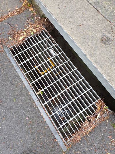
Tracing the creek from its source now becomes a matter of following the lie of the land and peering down grates in the roads to deep stormwater drains with yellow ladder rungs and sky glinting off water at the bottom.
We come to a corner where we can look down Salisbury Road. In the dip there is the paling fence that screens off Johnstons Creek where it modestly emerges from underground and continues its journey cosseted by an open air canal. But we have been there before so instead turn up the hill to imagine how rainwater runs above and below ground down towards the concrete creek. In a back lane a piece of wall-and-pavement graffiti helpfully depicts this process for us.
Our long walk has taken us through corner country where four suburbs meet. As we circle back to our starting point we find that those bill posters have renovated both sides of the underpass.
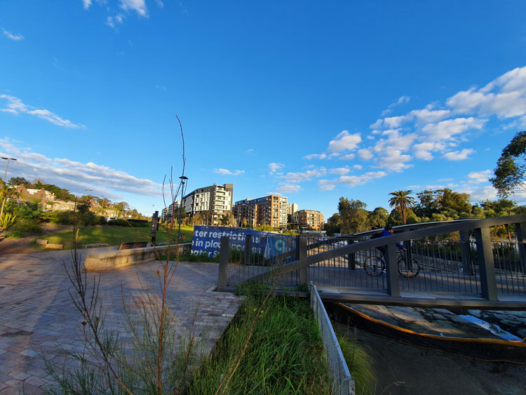
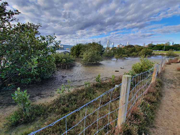
Impatient to see how the story ends, today I have leapt ahead to Glebe Foreshore Parkland. After its containment in concrete drains and stone canals, this is where Johnstons Creek is freed into Rozelle Bay, an arm of Sydney Harbour. Along this last stretch it almost looks like a real creek as it emerges from under the rail viaduct. But Sydney Water is in the process of further ‘naturalising’ it, with plans to create a natural planted stormwater system and increase the salt marsh around the creek.
It was not a good idea to come on a sunny Saturday. Social distancing is hard to maintain. Just last week police closed Bondi Beach because of the hordes gathered there to soak up the rays. No police in sight at Glebe Foreshore Parkland but, while not as crowded as Bondi, it has drawn many fresh air seekers. They ride their bikes, lounge at picnics, walk, jog, push past on narrow bridges, and watch their dogs attack other people’s dogs.
We decide against trying to cross a busy footbridge but peek through the safety fencing at the incipient salt marsh before scarpering back to the car.
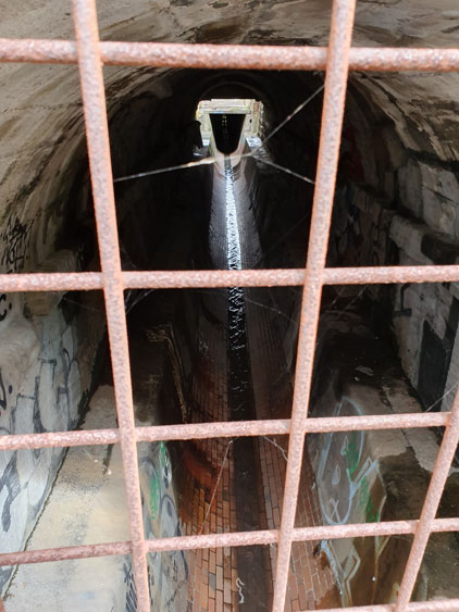
For the fourth of our piecemeal visits to Johnstons Creek we return to Parramatta Road and plunge into the narrow streets on the northern side where a light industrial triangle is squeezed between the creek and Pyrmont Bridge Road. The streets slope down to a concrete pathway that covers this section of the canal. We turn left and find ourselves at the sandstone bridge on Parramatta Road, where thousands of cars pass Stanmore McDonald’s every day. The creek traces a silvery line through the shadows under the road.
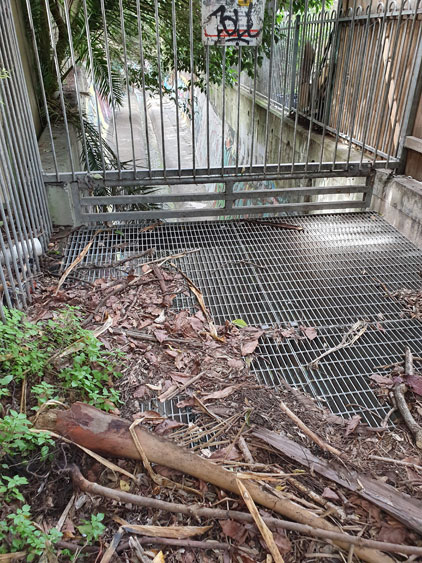
Turning around to follow the flow of the creek we walk between the backs of properties, respectable Victorian houses on one side, factories and derelict houses on the other. The path comes to an abrupt end at a metal grate and fence. Beyond is a deep channel of coolness where we can hear the creek falling. A bird calls from somewhere in the overhanging shrubbery.
We scramble up into a grassy area at the foot of Water Street. I will later read a lengthy real estate advertisement from 1850, when the farm here was subdivided into housing allotments. This grassy area is described as “a RESERVED WATERING PLACE at deep water on Johnstone’s Creek [that] will add materially to the comfort of the occupants”. There are still some residences in Water Street as well as warehouses and the last house before the reserve has a small but unusual garden.
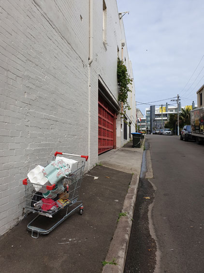
Walking back to the car I spot an abandoned shopping trolley and for a moment think I have come upon a cache of toilet paper. But no, the cartload only consists of styrofoam packaging cylinders.