Points and boundaries (Guest spot)

13iP1020383-SurveyPred

Photo: meganix

When I blogged about a chiselled, painted and Post-it noted survey mark recently, I invited Scott Taylor to comment and tell us more about survey marks. Scott is a surveyor who hosts the website Global Surveyors. This is what he had to say:


The red and white Post-it is actually called a Red and White!!! We aim our surveying instrument at the centre or join between the two colours, which we have positioned centrally over the survey mark.

There are many marks surveyors use, some placed in kerbs, rocks, trees, or buried under ground (hidden), and all on public record noted on a Deposited Plan.

Here are a couple of survey marks I happened to have on my phone. They are  called Drill Hole and Wings. Like the blue mark in your photo, they are used for boundaries and are noted on a plan as being at a corner, or being a certain bearing and distance from a corner. They assist the surveyor to re-establish a boundary corner when that corner has disappeared or been destroyed.

Photo: Scott Taylor

Photos: Scott Taylor

 We paint almost every mark we place. Surveyors have no particular colour. I use whatever is available and feel as though I’m a graffiti artist most of the time.

Here is a rock mark from the 1800s, before and after it’s been painted. It’s referred to as a Broad Arrow. For those interested in survey marks there is a great publication called Marking the landscape: a short history of survey marks in New South Wales.

Taylor_BroadArrow1


Photos: Scott Taylor

Photos: Scott Taylor


Flotsam and jetsam

Photograph presumably – but not necessarily – taken in Paris in May 1968. Original source not known.

Photograph presumably – but not necessarily – taken in Paris in May 1968. Original source not known.

‘Beneath the pavement, the beach’ – it’s the most well-known slogan from the May 1968 uprising in Paris. But what if it is misguided? What if the pavement is the beach?

I think the pavement is a littoral zone with tides of people and their vehicles washing backwards and forwards over it in their daily cycles of movement. Searching for graffiti on the pavement is like scavenging for sea drift on the sand.

Fish + “Sol”, Chippendale (Sydney), 2010.

Fish + “Sol”, Chippendale (Sydney), 2010.

Novelist Tim Winton, the author of Cloudstreet and Breathe, says he is ‘forever the beachcomber’. Passages in his book Land’s Edge  show just how much the search for pavement graffiti resembles beachcombing.

‘A long bare beach, like the sea itself, is capable of many surprises. The unexpected is what I’m after when I go trudging along the firm white sand  […] it’s the possibility of finding something strange that keeps me walking …

‘From the distance every found object is merely a black mark on the sand, and half the pleasure of beachcombing lies in wondering, anticipating the find …

‘Yet however comforting and peaceful beachcombing is, it ends up, like the sea, as disturbing as it is reassuring. In dark moments I believe that walking on a beach at low tide is to be looking for death, or at least anticipating it. You will only find the dead, the spilled and the cast-off […] The beachcomber goes looking for trouble, for everything he finds is a sign of trouble.’

Tributes to graffitist Ontre, hit by a train 2012.

Tributes to graffitist Ontre, hit by a train at Lewisham in 2012.


Tim Winton, Land’s Edge, Sydney: Picador, 1998, pp. 98-101.

Sgraffito

(Pedant alert – Vocabulary lesson ahead)

I noticed an article in the Sydney Morning Herald last week where the word ‘sgraffito’ was used – correctly – to describe ornate plaster work that has been uncovered during the restoration of Glebe Town Hall in Sydney: Peeling back the layers to reveal Glebe’s true history. Sgraffito is a centuries-old decorative technique used on ceramics and plaster walls. Apparently when Glebe Town Hall was built 130 years ago, artisans used this technique to carve a pattern in still-wet white plaster to selectively reveal the pink plaster below.


City of Sydney’s architecture design manager, Chris McBride, with the examples of sgraffito discovered at Glebe Town Hall. Photo: Ben Rushton (Sydney Morning Herald, 18 July 2012).

The word sgraffito (plural sgraffiti) comes from the Italian word graffiare, meaning ‘to cut or scratch in stone’. It seems to have been used in the English language in the 18th century to describe incised pottery, but by the 19th century the word graffito (plural graffiti) was being used to mean the kind of casual wall writing that had survived at archaeological sites in Italy (including Pompeii), Egypt and Syria, for example, or on churches and other public buildings in Europe from the Middle Ages.

Graffito/graffiti was not used in the English language to refer to contemporary inscriptions until later in the 19th century, but even so, in this sense it remained an infrequently-used term until the mid-20th century. Scholarly interest in the writing on toilet walls seems to have popularised the term in the 1960s and 1970s.

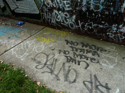
For my own project I have been trawling the digitised newspapers on the marvellous website Trove, looking for early examples of pavement graffiti in Australia. I have found plenty, but not by searching with the term ‘graffiti’. I had to use search terms like ‘pavement writing’ or ‘footpath writing’. Until the 1960s the word ‘graffiti’ does not appear in Australian newspapers except in occasional news items about archaeological discoveries. One of the earliest references to modern graffiti that I found was in a travel article in the Australian Women’s Weekly (!). Journeying through Hungary in 1969 the writer notes that she saw ‘modern graffiti slogans about American aggressors in Vietnam’ on a wall in one village.

By the way, the story goes that when George Lucas made the coming-of-age movie American Graffiti (released in 1973, set in 1962), Universal Pictures objected to the film’s title, not knowing what ‘American graffiti’ meant. Lucas is said to have been dismayed when some executives assumed he was making an Italian movie about feet. Although over 60 alternative titles were suggested, Lucas prevailed with his original choice.


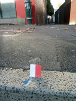
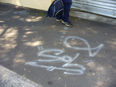
‘Scratch the surface’, King Street South, Newtown (Sydney), 2010.


References:

David, Bruno, and Meredith Wilson. 2002. Spaces of resistance: graffiti and Indigenous place markings in the early European contact period of northern Australia. In Inscribed Landscapes: Marking and Making Place, edited by B. David and M. Wilson. Honolulu: University of Hawai’i Press.

Fleming, Juliet. 2001. Graffiti and the writing arts of early modern England. Philadelphia: University of Philadelphia Press.

Reisner, Robert. 1971. Graffiti: two thousand years of wall writing. New York: Cowles Book Co., Inc.

‘American Graffiti’, Wikipedia, 23 July 2012.

Bluestone symbols (Guest spot)

Melbourne footpath enthusiast Dimitrios Kianidis took the photographs for today’s post

I have found another person who likes to keep his camera pointing downwards – or at least, he has found me through the Pavement graffiti website. When Dimitrios Kianidis posted a comment on this site in 2011 he had already self-published a book called Footpath graffiti: Coburg & Brunswick. It contains nearly 400 photographs, mostly inscriptions in wet concrete. Leafing through them is like reading a funny little book of very short poems. Dimitrios wanted to capture the social commentary scratched in concrete. “Most are so-and-so loves so-and-so,” he tells me, “But there are other messages and drawings as well. My favourites are:  ‘The Aborigines own this land’, ‘Santo and the Corinthians’, ‘I love Harrison Ford’, ‘RIP Blair 2006’, ‘RIP Cliff’, and ‘Dan is average!’  to mention just a few.” There are only a few copies of his book, but one of them is in Brunswick Library if you’re interested in seeing it.

But Dimitrios’s latest discovery is, as he puts it, ‘a whole language of numbers, letters and symbols carved into bluestone pavers’. The purpose of these inscriptions remains a mystery, although Dimitrios suspects they indicate the location of underground utility pipes and junctions. Any suggestions from knowledgeable blog followers would be welcome.

The ‘EA’ is particularly striking. “It is my favourite because it’s unlike any other that I have found. It’s beautifully carved and takes up the width of the paver and is visible from a short distance even to the casual observer. It’s in Albert Street on the pavement beside my favourite church too, St Patrick’s Cathedral.”

Politics

It is a warm Sunday afternoon in October, and we are on the forecourt of Old Parliament House – now called the Museum of Australian Democracy. The air is thick with fluffy seeds from Canberra’s avenues of exotic trees. In some places they lie in the gutters like drifts of snow. But despite the pleasant weather there is that sense of manicured desolation here that sightseers from other cities find remarkable about the national capital.

Perhaps it is not fair to judge the scarcity of people on this particular day. Potential visitors to museums have probably all been sucked away to the other side of Lake Burley Griffin where Floriade, the annual spring festival, is in full bloom.  We have chosen to avoid the flower beds and ferris wheels and instead are standing on the best example of pavement graffiti in the Australian Capital Territory.

The controversial Aboriginal Tent Embassy was originally established on the lawns of Old Parliament House in 1972, claiming to represent the political rights of Australian Aboriginal people. After being removed several times it has now been in place since 1992. There is an official Aboriginal Tent Embassy website, and you can also read a potted history on Wikipedia.

Today the tents and decorated sheds appear to be empty and all that there is to see are signs and flags, piles of firewood and a smear of smoke from the smouldering sacred fire. And of course, the decorated forecourt. Around its edges there are recently painted slogans and symbols, but mostly this expanse of paving is crowded with a worn menagerie of animals and plants painted in imitation of various styles of Aboriginal rock-art.

In their book Inscribed landscapes archaeologists Bruno David and Meredith Wilson draw parallels between Indigenous rock markings and graffiti. What better place than here at the Aboriginal Tent Embassy to reflect on their contention that all inscription, including modern graffiti and contact-period rock-art, is about the politics of turf. Inscriptions, they maintain, colonize space.

Nostalgia

Pavement artist, Stanmore (Sydney), 2009

Not only do I write a ‘Pavement graffiti’ blog, but I will soon be launching a website called ‘Pavement appreciation’. This is all connected with a postgraduate research project I have undertaken on ‘Reading the pavement’.  If it all sounds like some sort of obsession then I’m afraid it is. I was recently forced to speculate that I must have had a revelatory encounter with asphalt as a small child.

This is not as silly as it sounds. The surfaces of roadways and footpaths are such an ordinary part of our everyday lives that we tend to ignore them through familiarity. But we could probably all look back to memorable moments that involved asphalt or concrete pavements and the marks upon them – scabby knees and other gravel-rash injuries, arrow chases through suburban streets, jumping over the cracks in the footpath so as not to be eaten by bears, sweaty handball games on courts painted on the school playground, mastering the art of drawing a hopscotch the right size and shape. Some Sydney people will remember being puzzled as a child at seeing ‘Eternity’ chalked on the pavement in the city.

When Marcel Proust (À la recherche du temps perdu) describes impressions in the present that revive similar sensations from the past he mentions not only the taste of the madeleine, but the unevenness of the paving-stones. Occasionally you find childhood recollections of the pavement in the works of other writers as well. Clive James, for example, in his Unreliable Memoirs describes daredevil feats in his pram-wheeled billycart and the ‘slide of the back wheels which got me round the corner unscathed, leaving black smoking trails of burnt rubber’. And in her essay Earthworm Small, Barbara Hanrahan tells how her family moved to a better part of Adelaide in the 1950s, but ‘I kept on wanting the old suburb. Cracked asphalt, corrugated iron stamped with the trademark of a royal crown, lavatory creeper and morning glory …’.

I wrote about some of my experiences with chalk and pavement in a journal article a few years ago (Eternal City). This nostalgia carries over into my present project, but that is not necessarily a bad thing. I am vindicated by British academic Elizabeth Wilson, who writes in her article Looking backward: nostalgia and the city, ‘Although the practice of academic research is meant to be an objective activity, one part of the ‘postmodernisation’ of such work has been a greater recognition of our subjective investment in it. The anthropologist and psychoanalyst, George Devereux, once wrote that all research is autobiographical, and this seems particularly clear in recent writings about urban space and cities’.

Hopscotch, Carlton (Melbourne), 2008

Names set in concrete

In some of Sydney’s older municipalities the names of streets and parks were once set into the concrete footpaths. Reminders of a time when people got about on foot more regularly than they do now, some of these still exist around the suburbs. On this footpath in Chatswood, for example, the name ‘Lawrence Street’ appears to have been pressed into the concrete while it was wet.

Other examples are more elaborate. In parts of the former Municipality of Petersham (that is, Petersham, Lewisham and Stanmore) the name is embedded in the paving slab in contrasting red concrete. When one of these slabs gets broken you can sometimes see the wire formwork that holds the lettering in place.

Although many have been broken or mutilated over the years, local councils have begun to recognise the heritage value of these concrete names. The Marrickville Heritage Study of 1984-86, for example, lists street names on footpaths and kerbing as interesting examples of the type of works undertaken in the old Municipality of Petersham, adding that the remaining examples help to define the character of the area.

Despite the recent interest in preserving them, I have had some difficulty in obtaining specific information about how and when these pavement embellishments were originally made. However I did find from the Haberfield Conservation Study, prepared for Ashfield Council in 1988, that ‘blue and white enamel street name signs and red cement lettering of street name signs let into the footpath were … distinctive features’ of the model suburb of Haberfield developed by entrepreneur Richard Stanton between the years 1901 and 1922.

It seems likely that the Petersham street names came somewhat later. Now incorporated into the Marrickville local government area, the Municipality of Petersham was established in 1871. In 1929 its Council took out large loans to commence a program of paving its roads with concrete and replacing its asphalt footpaths with concrete at the same time.  These types of works became a major part of a program to provide employment for men during the Great Depression of 1930-1937.

By 1948 Allan M. Shepherd’s book The Story of Petersham was able to boast that “today only a very small proportion of the total length of all the footpath paving of the Municipality is not of concrete” and that “there are no unmade roads, lanes or footpaths, and every thoroughfare is in good condition”. Shepherd’s book does not mention the concrete street names specifically, but it is safe to assume that the making of these was included in that great concreting project of the 1930s.

For several years I have been monitoring a badly cracked ‘Liberty Street’ name in the footpath on the corner of Cavendish Street, Stanmore. In May 2010 I thought its days were numbered when I saw sprayed marks on the footpath indicating that Marrickville Council was going to construct a pram ramp on the kerb.

However some months later I found that the rectangle of old concrete bearing the name had been saved, although it was surrounded by incongruously white modern concrete and a straight cut had been made in it so that it could conform to the slope of the ramp.

Maps

At this point in my Pavement Graffiti project I’m thinking about maps – the formal and the informal, the fanciful and the accidental.

Two lovely books that I ordered arrived on my doorstep this week. The first is Kris Harzinski’s From here to there:  a curious collection from the Hand Drawn Map Association. It contains the kind of mud maps that people draw for one another on the back of an envelope or on a page torn from a notebook. Harzinski is just as interested in the story behind the map as he is in the map itself. But he doesn’t use the term ‘mud map’. It was only while researching this blog post that I realised that this term, which I use from time to time, is Australian in origin.

The second book is The map as art: contemporary artists explore cartography by Katharine Harmon. There are 360 works reproduced here. Described on the back cover blurb as ‘a collection of visionary topographies and imaginary geographies’, these artworks are executed in many different media. Two I particularly liked featured map-like marks on the ground: Nina Katchdourian’s Moss Maps are ‘scrambled atlases’ of lichen on granite rocks; the Rock Maps of eight-year old artist Theodore Lamb are photographs of cracks in rocks.

Lamb’s Rock Maps remind me of photographs I have taken of cracks in asphalt. They show up best after rain and this ‘map’, taken in Stanmore (Sydney), even includes a sky-coloured lake.


Last year I photographed a wonderful map drawn by a boy on the footpath outside his house in Rozelle. His play world grew each day.

Expletive deleted

Cadigal Reserve, Summer Hill

The signs, symbols and graffiti on the ground are all evidence of a territorial battle that is being waged among government authorities, property owners, motorists, cyclists and pedestrians. Now the stencils themselves are getting in on the act. It is clear that this walker has cracked up and has said something sharp to the bicycle. But a zealous graffiti obliterator has painted over his speech balloon and now we’ll never know what it was he said.

These particular stencils are on a pathway in Cadigal Reserve in Summer Hill. The pathway continues along beside Hawthorne Canal, which eventually runs into an arm of Parramatta River. 

The canal has a history of successive waves of pollution. Originally a stream called Long Cove Creek by early European settlers in Sydney, by the late 1800s it was fouled with house slops and the run-off from factories and slaughterhouses. The stink that it gave off was considered to be a health hazard and eventually it was excavated, re-aligned and lined with concrete in 1895 and renamed Hawthorne Canal.

But over the years the stormwater it collects has still been polluted with leaking sewage and dirt, horse manure, oil, chemicals, plastics, heavy metals and garbage washed off the roads and nearby rubbish dumps. And then, some time in 1990s, the canal was subjected to what some people regard as visual pollution – graffiti.

Hawthorne Canal, Summer Hill

Taggers and graffiti artists continue to express themselves on the walls and under the bridges there. Their marks have spread to the pathway beside the canal. Government authorities and a bush regeneration group have done much to improve the banks of the canal in recent years, so it is understandable that they might want to remove ‘unsightly’ graffiti from the asphalt. They can’t win though. More pavement graffiti has appeared since the last applications of grey paint. But I wish I had been there before they covered up that pedestrian’s outburst.

(Some of the information for this post was obtained from Hawthorne Canal – the history of Long Cove Creek, written by Mark Sabolch and published by the Ashfield & District Historical Society in association with the Inner West Environmental Group in 2006)

Arcades

The arcades of Paris (les passages couverts) were a shopping sensation in the 19th century and they are still famous, not least because Walter Benjamin’s great unfinished work The Arcades Project (Das Passagen-Werk) used a study of the arcades as a way of revealing insights into the realities of urban living.

There were some 150 of these arcades built between 1800 and 1850. In their day they offered a treasure-trove to shoppers in Paris away from the weather and the dirty, unpaved streets. Now there are fewer than 20 left, most of them in run-down condition but still offering a variety of shopping and eating experiences. The pavements – or floors – of the arcades carry the story of their decline (or sometimes their revival, as in the case of the almost-glamorous Galerie Vivienne).

In a stretch of the Passage des Panoramas that I photographed parts of the original paving had been replaced by asphalt, but there were some sections of flagstone and a few shops had remnants of the original coloured tiling – a different pattern for each shop, sometimes with the name of the original business spelt out in tiles. Others had rectangles of synthetic carpet outside their premises.