Photo: meganix
When I blogged about a chiselled, painted and Post-it noted survey mark recently, I invited Scott Taylor to comment and tell us more about survey marks. Scott is a surveyor who hosts the website Global Surveyors. This is what he had to say:
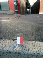
The red and white Post-it is actually called a Red and White!!! We aim our surveying instrument at the centre or join between the two colours, which we have positioned centrally over the survey mark.
There are many marks surveyors use, some placed in kerbs, rocks, trees, or buried under ground (hidden), and all on public record noted on a Deposited Plan.
Here are a couple of survey marks I happened to have on my phone. They are  called Drill Hole and Wings. Like the blue mark in your photo, they are used for boundaries and are noted on a plan as being at a corner, or being a certain bearing and distance from a corner. They assist the surveyor to re-establish a boundary corner when that corner has disappeared or been destroyed.
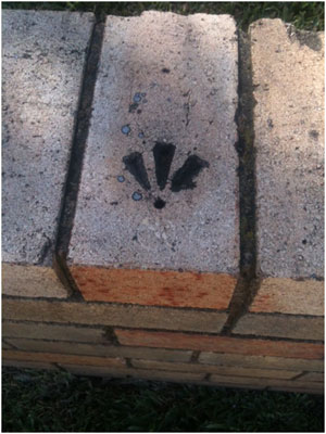

- Photos: Scott Taylor
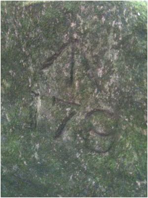
 We paint almost every mark we place. Surveyors have no particular colour. I use whatever is available and feel as though I’m a graffiti artist most of the time.
Here is a rock mark from the 1800s, before and after it’s been painted. It’s referred to as a Broad Arrow. For those interested in survey marks there is a great publication called Marking the landscape: a short history of survey marks in New South Wales.
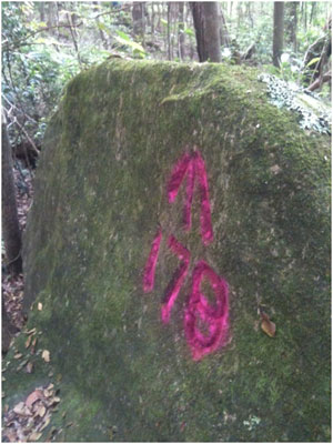
Photos: Scott Taylor